You are here: Home > Network List > IW - Intermountain West Stations List
> Station DLMT Dillon, Montana, USA > Earthquake Result Viewer
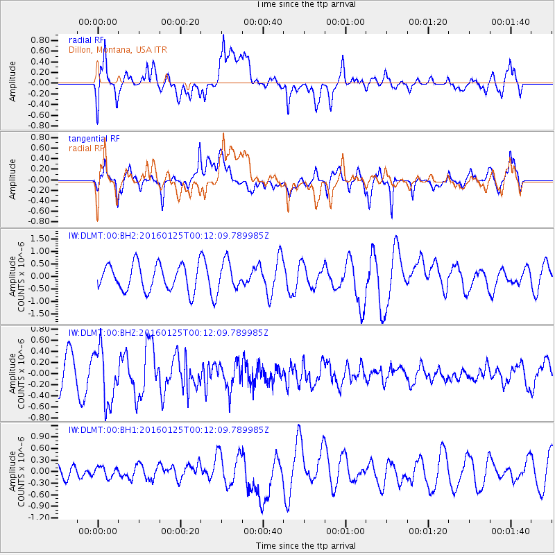
DLMT Dillon, Montana, USA - Earthquake Result Viewer
*The percent match for this event was below the threshold and hence no stack was calculated.
| Earthquake location: |
Tonga Islands |
| Earthquake latitude/longitude: |
-19.6/-173.4 |
| Earthquake time(UTC): |
2016/01/25 (025) 00:00:09 GMT |
| Earthquake Depth: |
40 km |
| Earthquake Magnitude: |
5.7 MB |
| Earthquake Catalog/Contributor: |
NEIC PDE/NEIC COMCAT |
|
| Network: |
IW Intermountain West |
| Station: |
DLMT Dillon, Montana, USA |
| Lat/Lon: |
45.36 N/112.60 W |
| Elevation: |
1569 m |
|
| Distance: |
85.0 deg |
| Az: |
38.157 deg |
| Baz: |
235.709 deg |
| Ray Param: |
$rayparam |
*The percent match for this event was below the threshold and hence was not used in the summary stack. |
|
| Radial Match: |
81.7499 % |
| Radial Bump: |
400 |
| Transverse Match: |
76.82633 % |
| Transverse Bump: |
400 |
| SOD ConfigId: |
1399611 |
| Insert Time: |
2016-02-08 03:11:02.171 +0000 |
| GWidth: |
2.5 |
| Max Bumps: |
400 |
| Tol: |
0.001 |
|
Signal To Noise
| Channel | StoN | STA | LTA |
| IW:DLMT:00:BHZ:20160125T00:12:09.789985Z | 1.9618546 | 4.9361705E-7 | 2.5160736E-7 |
| IW:DLMT:00:BH1:20160125T00:12:09.789985Z | 0.49183828 | 1.3527082E-7 | 2.750311E-7 |
| IW:DLMT:00:BH2:20160125T00:12:09.789985Z | 1.0502292 | 5.426183E-7 | 5.166666E-7 |
| Arrivals |
| Ps | |
| PpPs | |
| PsPs/PpSs | |


