You are here: Home > Network List > TA - USArray Transportable Network (new EarthScope stations) Stations List
> Station T25A Trinidad, CO, USA > Earthquake Result Viewer
T25A Trinidad, CO, USA - Earthquake Result Viewer

| Earthquake location: |
Near S. Coast Of Honshu, Japan |
| Earthquake latitude/longitude: |
33.2/137.9 |
| Earthquake time(UTC): |
2009/08/09 (221) 10:55:55 GMT |
| Earthquake Depth: |
297 km |
| Earthquake Magnitude: |
6.5 MB, 7.1 MW, 7.1 MW |
| Earthquake Catalog/Contributor: |
WHDF/NEIC |
|
| Network: |
TA USArray Transportable Network (new EarthScope stations) |
| Station: |
T25A Trinidad, CO, USA |
| Lat/Lon: |
37.14 N/104.41 W |
| Elevation: |
2017 m |
|
| Distance: |
89.1 deg |
| Az: |
45.07 deg |
| Baz: |
312.006 deg |
| Ray Param: |
0.04170189 |
| Estimated Moho Depth: |
31.5 km |
| Estimated Crust Vp/Vs: |
2.01 |
| Assumed Crust Vp: |
6.316 km/s |
| Estimated Crust Vs: |
3.138 km/s |
| Estimated Crust Poisson's Ratio: |
0.34 |
|
| Radial Match: |
91.99195 % |
| Radial Bump: |
400 |
| Transverse Match: |
87.774414 % |
| Transverse Bump: |
400 |
| SOD ConfigId: |
2622 |
| Insert Time: |
2010-03-06 02:45:29.504 +0000 |
| GWidth: |
2.5 |
| Max Bumps: |
400 |
| Tol: |
0.001 |
|
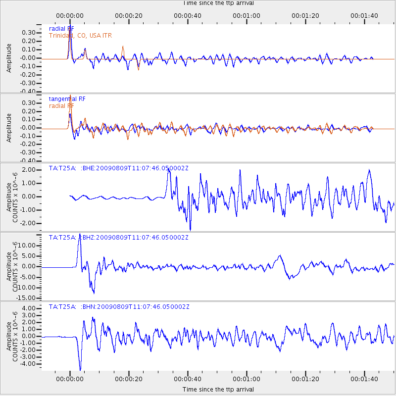
Signal To Noise
| Channel | StoN | STA | LTA |
| TA:T25A: :BHZ:20090809T11:07:46.050002Z | 95.68307 | 5.7824645E-6 | 6.043352E-8 |
| TA:T25A: :BHN:20090809T11:07:46.050002Z | 33.9647 | 1.795203E-6 | 5.285497E-8 |
| TA:T25A: :BHE:20090809T11:07:46.050002Z | 11.513244 | 9.071604E-7 | 7.879278E-8 |
| Arrivals |
| Ps | 5.1 SECOND |
| PpPs | 15 SECOND |
| PsPs/PpSs | 20 SECOND |


