You are here: Home > Network List > US - United States National Seismic Network Stations List
> Station AMTX Amarillo, Texas, USA > Earthquake Result Viewer
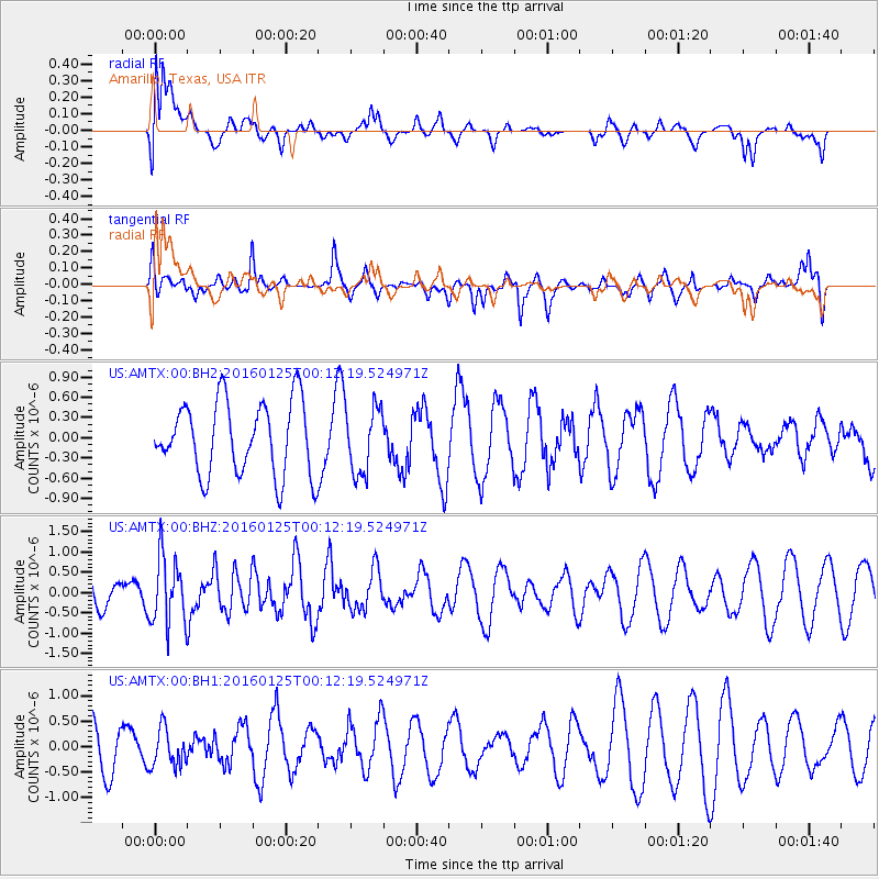
AMTX Amarillo, Texas, USA - Earthquake Result Viewer
*The percent match for this event was below the threshold and hence no stack was calculated.
| Earthquake location: |
Tonga Islands |
| Earthquake latitude/longitude: |
-19.6/-173.4 |
| Earthquake time(UTC): |
2016/01/25 (025) 00:00:09 GMT |
| Earthquake Depth: |
40 km |
| Earthquake Magnitude: |
5.7 MB |
| Earthquake Catalog/Contributor: |
NEIC PDE/NEIC COMCAT |
|
| Network: |
US United States National Seismic Network |
| Station: |
AMTX Amarillo, Texas, USA |
| Lat/Lon: |
34.53 N/101.41 W |
| Elevation: |
1010 m |
|
| Distance: |
87.0 deg |
| Az: |
51.835 deg |
| Baz: |
243.874 deg |
| Ray Param: |
$rayparam |
*The percent match for this event was below the threshold and hence was not used in the summary stack. |
|
| Radial Match: |
66.7387 % |
| Radial Bump: |
400 |
| Transverse Match: |
50.213642 % |
| Transverse Bump: |
400 |
| SOD ConfigId: |
1399611 |
| Insert Time: |
2016-02-08 03:12:04.888 +0000 |
| GWidth: |
2.5 |
| Max Bumps: |
400 |
| Tol: |
0.001 |
|
Signal To Noise
| Channel | StoN | STA | LTA |
| US:AMTX:00:BHZ:20160125T00:12:19.524971Z | 1.9653596 | 8.313109E-7 | 4.229816E-7 |
| US:AMTX:00:BH1:20160125T00:12:19.524971Z | 1.021591 | 3.7051652E-7 | 3.6268577E-7 |
| US:AMTX:00:BH2:20160125T00:12:19.524971Z | 0.8760229 | 4.767771E-7 | 5.442519E-7 |
| Arrivals |
| Ps | |
| PpPs | |
| PsPs/PpSs | |


