T25A Trinidad, CO, USA - Earthquake Result Viewer
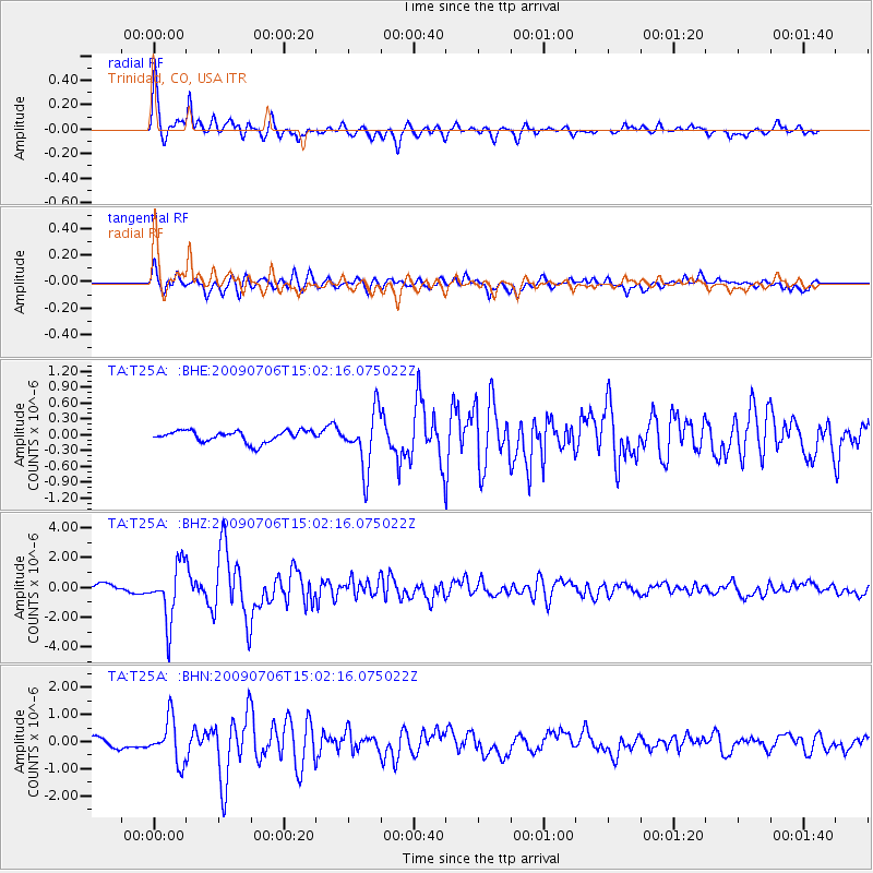
Earthquake location: Rat Islands, Aleutian Islands
Earthquake latitude/longitude: 50.4/177.0
Earthquake time(UTC): 2009/07/06 (187) 14:53:12 GMT
Earthquake Depth: 22 km
Earthquake Magnitude: 6.0 MB, 5.8 MS, 6.1 MW, 6.0 MW
Earthquake Catalog/Contributor: WHDF/NEIC
Network: TA USArray Transportable Network (new EarthScope stations)
Station: T25A Trinidad, CO, USA
Lat/Lon: 37.14 N/104.41 W
Elevation: 2017 m
Distance: 55.7 deg
Az: 71.442 deg
Baz: 310.656 deg
Ray Param: 0.06457913
Estimated Moho Depth: 30.75 km
Estimated Crust Vp/Vs: 2.08
Assumed Crust Vp: 6.316 km/s
Estimated Crust Vs: 3.033 km/s
Estimated Crust Poisson's Ratio: 0.35
Radial Match: 91.72904 %
Radial Bump: 354
Transverse Match: 86.38838 %
Transverse Bump: 400
SOD ConfigId: 2648
Insert Time: 2010-03-06 02:46:02.651 +0000
GWidth: 2.5
Max Bumps: 400
Tol: 0.001

Signal To Noise

ChannelStoNSTALTA
TA:T25A: :BHZ:20090706T15:02:16.075022Z9.8757061.8783718E-61.9020126E-7
TA:T25A: :BHN:20090706T15:02:16.075022Z3.79451167.8249366E-72.0621724E-7
TA:T25A: :BHE:20090706T15:02:16.075022Z4.96474935.3435457E-71.0762972E-7
Arrivals
Ps5.5 SECOND
PpPs14 SECOND
PsPs/PpSs20 SECOND