You are here: Home > Network List > UW - Pacific Northwest Regional Seismic Network Stations List
> Station LEBA Lebam, WA, USA > Earthquake Result Viewer
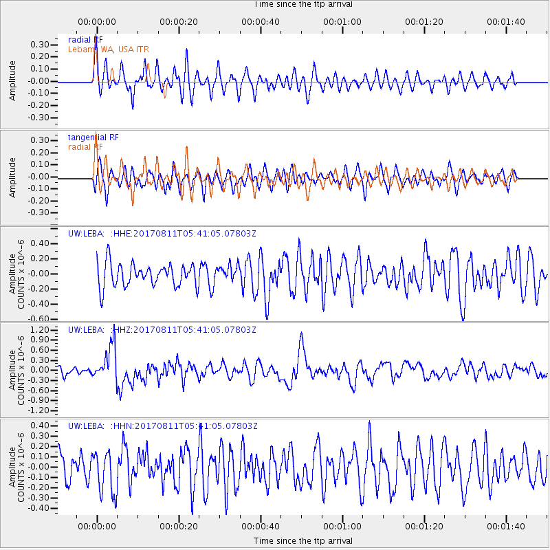
LEBA Lebam, WA, USA - Earthquake Result Viewer
*The percent match for this event was below the threshold and hence no stack was calculated.
| Earthquake location: |
Luzon, Philippines |
| Earthquake latitude/longitude: |
14.0/120.7 |
| Earthquake time(UTC): |
2017/08/11 (223) 05:28:25 GMT |
| Earthquake Depth: |
168 km |
| Earthquake Magnitude: |
6.2 Mww |
| Earthquake Catalog/Contributor: |
NEIC PDE/us |
|
| Network: |
UW Pacific Northwest Regional Seismic Network |
| Station: |
LEBA Lebam, WA, USA |
| Lat/Lon: |
46.55 N/123.56 W |
| Elevation: |
73 m |
|
| Distance: |
96.7 deg |
| Az: |
38.76 deg |
| Baz: |
298.303 deg |
| Ray Param: |
$rayparam |
*The percent match for this event was below the threshold and hence was not used in the summary stack. |
|
| Radial Match: |
64.82305 % |
| Radial Bump: |
400 |
| Transverse Match: |
50.721985 % |
| Transverse Bump: |
400 |
| SOD ConfigId: |
13570011 |
| Insert Time: |
2019-04-28 13:58:30.011 +0000 |
| GWidth: |
2.5 |
| Max Bumps: |
400 |
| Tol: |
0.001 |
|
Signal To Noise
| Channel | StoN | STA | LTA |
| UW:LEBA: :HHZ:20170811T05:41:05.07803Z | 5.137274 | 5.5232323E-7 | 1.075129E-7 |
| UW:LEBA: :HHN:20170811T05:41:05.07803Z | 1.0259678 | 2.0972747E-7 | 2.0441915E-7 |
| UW:LEBA: :HHE:20170811T05:41:05.07803Z | 0.7082997 | 1.0577453E-7 | 1.4933585E-7 |
| Arrivals |
| Ps | |
| PpPs | |
| PsPs/PpSs | |


