You are here: Home > Network List > UU - University of Utah Regional Network Stations List
> Station FORU South Mineral Mountains, UT, USA > Earthquake Result Viewer
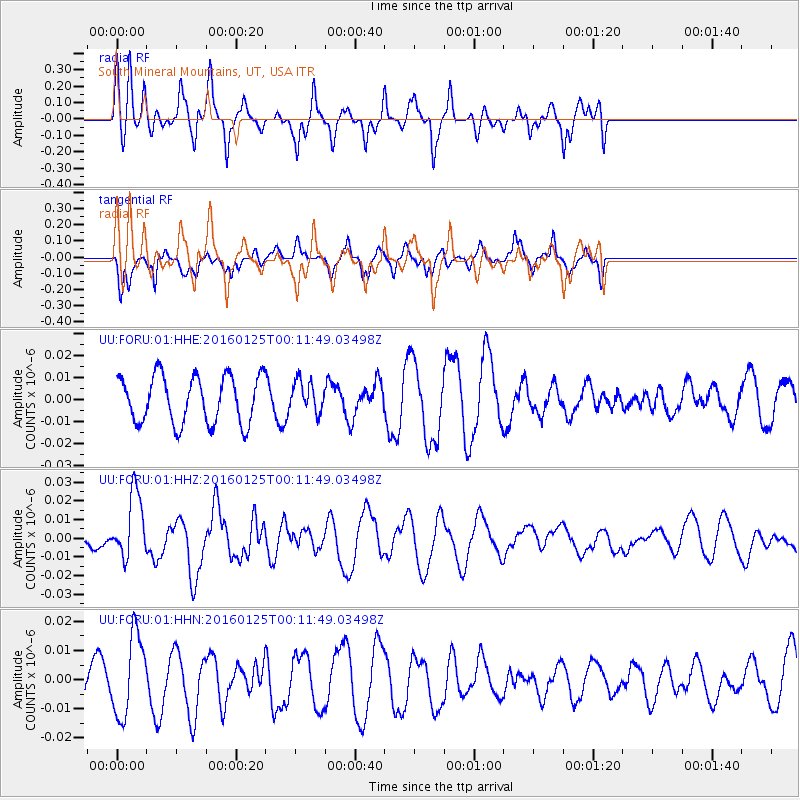
FORU South Mineral Mountains, UT, USA - Earthquake Result Viewer
*The percent match for this event was below the threshold and hence no stack was calculated.
| Earthquake location: |
Tonga Islands |
| Earthquake latitude/longitude: |
-19.6/-173.4 |
| Earthquake time(UTC): |
2016/01/25 (025) 00:00:09 GMT |
| Earthquake Depth: |
40 km |
| Earthquake Magnitude: |
5.7 MB |
| Earthquake Catalog/Contributor: |
NEIC PDE/NEIC COMCAT |
|
| Network: |
UU University of Utah Regional Network |
| Station: |
FORU South Mineral Mountains, UT, USA |
| Lat/Lon: |
38.46 N/112.86 W |
| Elevation: |
1840 m |
|
| Distance: |
80.9 deg |
| Az: |
43.804 deg |
| Baz: |
236.226 deg |
| Ray Param: |
$rayparam |
*The percent match for this event was below the threshold and hence was not used in the summary stack. |
|
| Radial Match: |
73.12076 % |
| Radial Bump: |
400 |
| Transverse Match: |
39.011326 % |
| Transverse Bump: |
292 |
| SOD ConfigId: |
1399611 |
| Insert Time: |
2016-02-08 03:13:39.428 +0000 |
| GWidth: |
2.5 |
| Max Bumps: |
400 |
| Tol: |
0.001 |
|
Signal To Noise
| Channel | StoN | STA | LTA |
| UU:FORU:01:HHZ:20160125T00:11:49.03498Z | 2.300583 | 1.7743055E-8 | 7.712417E-9 |
| UU:FORU:01:HHN:20160125T00:11:49.03498Z | 2.0872598 | 1.4113581E-8 | 6.761775E-9 |
| UU:FORU:01:HHE:20160125T00:11:49.03498Z | 0.65302616 | 6.9847914E-9 | 1.0696036E-8 |
| Arrivals |
| Ps | |
| PpPs | |
| PsPs/PpSs | |


