You are here: Home > Network List > CI - Caltech Regional Seismic Network Stations List
> Station DGR Domenigoni Reservoir, California, USA > Earthquake Result Viewer
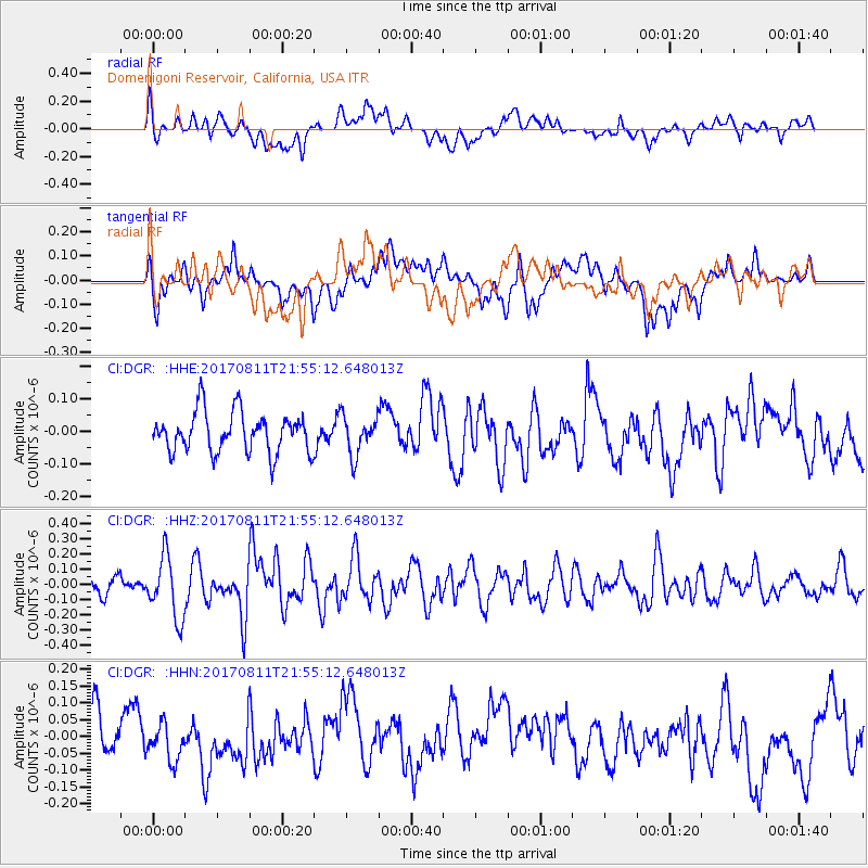
DGR Domenigoni Reservoir, California, USA - Earthquake Result Viewer
*The percent match for this event was below the threshold and hence no stack was calculated.
| Earthquake location: |
Near Coast Of Peru |
| Earthquake latitude/longitude: |
-16.3/-73.5 |
| Earthquake time(UTC): |
2017/08/11 (223) 21:45:09 GMT |
| Earthquake Depth: |
35 km |
| Earthquake Magnitude: |
5.6 Mww |
| Earthquake Catalog/Contributor: |
NEIC PDE/us |
|
| Network: |
CI Caltech Regional Seismic Network |
| Station: |
DGR Domenigoni Reservoir, California, USA |
| Lat/Lon: |
33.65 N/117.01 W |
| Elevation: |
609 m |
|
| Distance: |
64.7 deg |
| Az: |
320.558 deg |
| Baz: |
132.998 deg |
| Ray Param: |
$rayparam |
*The percent match for this event was below the threshold and hence was not used in the summary stack. |
|
| Radial Match: |
56.35629 % |
| Radial Bump: |
400 |
| Transverse Match: |
56.785477 % |
| Transverse Bump: |
400 |
| SOD ConfigId: |
13570011 |
| Insert Time: |
2019-04-28 14:00:29.434 +0000 |
| GWidth: |
2.5 |
| Max Bumps: |
400 |
| Tol: |
0.001 |
|
Signal To Noise
| Channel | StoN | STA | LTA |
| CI:DGR: :HHZ:20170811T21:55:12.648013Z | 3.4534426 | 2.0228181E-7 | 5.8573963E-8 |
| CI:DGR: :HHN:20170811T21:55:12.648013Z | 0.67586106 | 5.2880083E-8 | 7.824106E-8 |
| CI:DGR: :HHE:20170811T21:55:12.648013Z | 0.9409281 | 5.8255424E-8 | 6.191272E-8 |
| Arrivals |
| Ps | |
| PpPs | |
| PsPs/PpSs | |


