You are here: Home > Network List > LD - Lamont-Doherty Cooperative Seismographic Network Stations List
> Station MVL Millersville University, PA > Earthquake Result Viewer
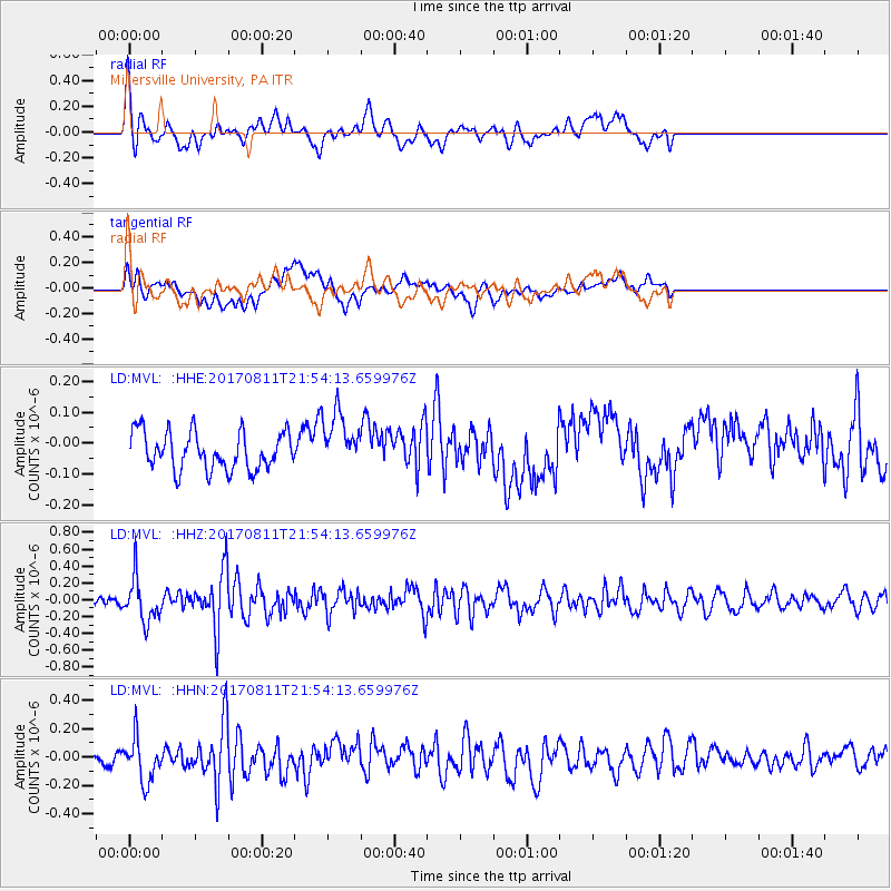
MVL Millersville University, PA - Earthquake Result Viewer
*The percent match for this event was below the threshold and hence no stack was calculated.
| Earthquake location: |
Near Coast Of Peru |
| Earthquake latitude/longitude: |
-16.3/-73.5 |
| Earthquake time(UTC): |
2017/08/11 (223) 21:45:09 GMT |
| Earthquake Depth: |
35 km |
| Earthquake Magnitude: |
5.6 Mww |
| Earthquake Catalog/Contributor: |
NEIC PDE/us |
|
| Network: |
LD Lamont-Doherty Cooperative Seismographic Network |
| Station: |
MVL Millersville University, PA |
| Lat/Lon: |
40.00 N/76.35 W |
| Elevation: |
91 m |
|
| Distance: |
56.1 deg |
| Az: |
357.342 deg |
| Baz: |
176.677 deg |
| Ray Param: |
$rayparam |
*The percent match for this event was below the threshold and hence was not used in the summary stack. |
|
| Radial Match: |
74.46491 % |
| Radial Bump: |
400 |
| Transverse Match: |
59.878082 % |
| Transverse Bump: |
400 |
| SOD ConfigId: |
13570011 |
| Insert Time: |
2019-04-28 14:03:06.389 +0000 |
| GWidth: |
2.5 |
| Max Bumps: |
400 |
| Tol: |
0.001 |
|
Signal To Noise
| Channel | StoN | STA | LTA |
| LD:MVL: :HHZ:20170811T21:54:13.659976Z | 4.507428 | 2.5476103E-7 | 5.6520264E-8 |
| LD:MVL: :HHN:20170811T21:54:13.659976Z | 3.243361 | 1.5264901E-7 | 4.706507E-8 |
| LD:MVL: :HHE:20170811T21:54:13.659976Z | 1.4437271 | 8.740812E-8 | 6.054338E-8 |
| Arrivals |
| Ps | |
| PpPs | |
| PsPs/PpSs | |


