You are here: Home > Network List > IU - Global Seismograph Network (GSN - IRIS/USGS) Stations List
> Station KMBO Kilima Mbogo, Kenya > Earthquake Result Viewer
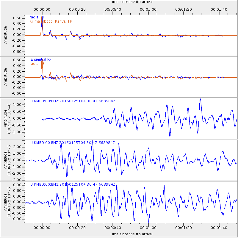
KMBO Kilima Mbogo, Kenya - Earthquake Result Viewer

| Earthquake location: |
Strait Of Gibraltar |
| Earthquake latitude/longitude: |
35.7/-3.6 |
| Earthquake time(UTC): |
2016/01/25 (025) 04:22:02 GMT |
| Earthquake Depth: |
10 km |
| Earthquake Magnitude: |
6.1 MWP |
| Earthquake Catalog/Contributor: |
NEIC PDE/NEIC COMCAT |
|
| Network: |
IU Global Seismograph Network (GSN - IRIS/USGS) |
| Station: |
KMBO Kilima Mbogo, Kenya |
| Lat/Lon: |
1.13 S/37.25 E |
| Elevation: |
1950 m |
|
| Distance: |
52.9 deg |
| Az: |
124.87 deg |
| Baz: |
318.119 deg |
| Ray Param: |
0.06649379 |
| Estimated Moho Depth: |
42.75 km |
| Estimated Crust Vp/Vs: |
1.66 |
| Assumed Crust Vp: |
6.601 km/s |
| Estimated Crust Vs: |
3.976 km/s |
| Estimated Crust Poisson's Ratio: |
0.22 |
|
| Radial Match: |
94.62121 % |
| Radial Bump: |
254 |
| Transverse Match: |
89.11085 % |
| Transverse Bump: |
400 |
| SOD ConfigId: |
1399611 |
| Insert Time: |
2016-02-08 04:54:44.392 +0000 |
| GWidth: |
2.5 |
| Max Bumps: |
400 |
| Tol: |
0.001 |
|
Signal To Noise
| Channel | StoN | STA | LTA |
| IU:KMBO:00:BHZ:20160125T04:30:47.668984Z | 5.0395713 | 3.1749184E-7 | 6.2999774E-8 |
| IU:KMBO:00:BH1:20160125T04:30:47.668984Z | 1.9150001 | 8.0394074E-8 | 4.1981238E-8 |
| IU:KMBO:00:BH2:20160125T04:30:47.668984Z | 2.7532916 | 1.13263845E-7 | 4.113761E-8 |
| Arrivals |
| Ps | 4.5 SECOND |
| PpPs | 16 SECOND |
| PsPs/PpSs | 21 SECOND |


