You are here: Home > Network List > TA - USArray Transportable Network (new EarthScope stations) Stations List
> Station 226A Malaga, Loving, NM, USA > Earthquake Result Viewer
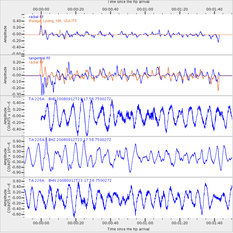
226A Malaga, Loving, NM, USA - Earthquake Result Viewer
*The percent match for this event was below the threshold and hence no stack was calculated.
| Earthquake location: |
Komandorskiye Ostrova Region |
| Earthquake latitude/longitude: |
56.3/164.1 |
| Earthquake time(UTC): |
2008/09/12 (256) 23:07:50 GMT |
| Earthquake Depth: |
9.3 km |
| Earthquake Magnitude: |
5.5 MB, 5.7 MS, 5.9 MW, 5.9 MW |
| Earthquake Catalog/Contributor: |
WHDF/NEIC |
|
| Network: |
TA USArray Transportable Network (new EarthScope stations) |
| Station: |
226A Malaga, Loving, NM, USA |
| Lat/Lon: |
32.06 N/104.10 W |
| Elevation: |
929 m |
|
| Distance: |
64.9 deg |
| Az: |
69.536 deg |
| Baz: |
322.049 deg |
| Ray Param: |
$rayparam |
*The percent match for this event was below the threshold and hence was not used in the summary stack. |
|
| Radial Match: |
46.01995 % |
| Radial Bump: |
400 |
| Transverse Match: |
73.98021 % |
| Transverse Bump: |
400 |
| SOD ConfigId: |
2560 |
| Insert Time: |
2010-03-06 02:48:27.693 +0000 |
| GWidth: |
2.5 |
| Max Bumps: |
400 |
| Tol: |
0.001 |
|
Signal To Noise
| Channel | StoN | STA | LTA |
| TA:226A: :BHZ:20080912T23:17:58.750027Z | 2.6192522 | 5.42742E-7 | 2.0721258E-7 |
| TA:226A: :BHN:20080912T23:17:58.750027Z | 0.8321468 | 2.1055808E-7 | 2.5302998E-7 |
| TA:226A: :BHE:20080912T23:17:58.750027Z | 0.78952074 | 2.0885247E-7 | 2.6453068E-7 |
| Arrivals |
| Ps | |
| PpPs | |
| PsPs/PpSs | |


