You are here: Home > Network List > NE - New England Seismic Network Stations List
> Station PQI Presque Isle, ME, USA > Earthquake Result Viewer
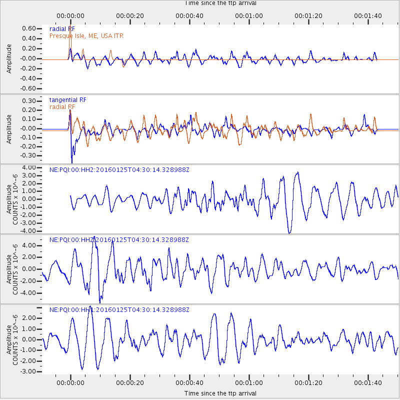
PQI Presque Isle, ME, USA - Earthquake Result Viewer
*The percent match for this event was below the threshold and hence no stack was calculated.
| Earthquake location: |
Strait Of Gibraltar |
| Earthquake latitude/longitude: |
35.7/-3.6 |
| Earthquake time(UTC): |
2016/01/25 (025) 04:22:02 GMT |
| Earthquake Depth: |
10 km |
| Earthquake Magnitude: |
6.1 MWP |
| Earthquake Catalog/Contributor: |
NEIC PDE/NEIC COMCAT |
|
| Network: |
NE New England Seismic Network |
| Station: |
PQI Presque Isle, ME, USA |
| Lat/Lon: |
46.67 N/68.02 W |
| Elevation: |
162 m |
|
| Distance: |
48.4 deg |
| Az: |
303.876 deg |
| Baz: |
78.765 deg |
| Ray Param: |
$rayparam |
*The percent match for this event was below the threshold and hence was not used in the summary stack. |
|
| Radial Match: |
77.96727 % |
| Radial Bump: |
400 |
| Transverse Match: |
73.2126 % |
| Transverse Bump: |
400 |
| SOD ConfigId: |
1399611 |
| Insert Time: |
2016-02-08 04:56:25.844 +0000 |
| GWidth: |
2.5 |
| Max Bumps: |
400 |
| Tol: |
0.001 |
|
Signal To Noise
| Channel | StoN | STA | LTA |
| NE:PQI:00:HHZ:20160125T04:30:14.328988Z | 1.3840494 | 1.9379922E-6 | 1.4002335E-6 |
| NE:PQI:00:HH1:20160125T04:30:14.328988Z | 1.9272279 | 1.5746824E-6 | 8.170712E-7 |
| NE:PQI:00:HH2:20160125T04:30:14.328988Z | 1.2569715 | 8.4304565E-7 | 6.7069595E-7 |
| Arrivals |
| Ps | |
| PpPs | |
| PsPs/PpSs | |


