You are here: Home > Network List > US - United States National Seismic Network Stations List
> Station CBKS Cedar Bluff, Kansas, USA > Earthquake Result Viewer
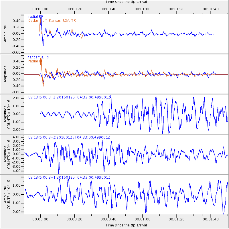
CBKS Cedar Bluff, Kansas, USA - Earthquake Result Viewer
*The percent match for this event was below the threshold and hence no stack was calculated.
| Earthquake location: |
Strait Of Gibraltar |
| Earthquake latitude/longitude: |
35.7/-3.6 |
| Earthquake time(UTC): |
2016/01/25 (025) 04:22:02 GMT |
| Earthquake Depth: |
10 km |
| Earthquake Magnitude: |
6.1 MWP |
| Earthquake Catalog/Contributor: |
NEIC PDE/NEIC COMCAT |
|
| Network: |
US United States National Seismic Network |
| Station: |
CBKS Cedar Bluff, Kansas, USA |
| Lat/Lon: |
38.81 N/99.74 W |
| Elevation: |
677 m |
|
| Distance: |
72.8 deg |
| Az: |
305.616 deg |
| Baz: |
57.837 deg |
| Ray Param: |
$rayparam |
*The percent match for this event was below the threshold and hence was not used in the summary stack. |
|
| Radial Match: |
73.82826 % |
| Radial Bump: |
270 |
| Transverse Match: |
54.754616 % |
| Transverse Bump: |
312 |
| SOD ConfigId: |
1399611 |
| Insert Time: |
2016-02-08 04:57:54.749 +0000 |
| GWidth: |
2.5 |
| Max Bumps: |
400 |
| Tol: |
0.001 |
|
Signal To Noise
| Channel | StoN | STA | LTA |
| US:CBKS:00:BHZ:20160125T04:33:00.499001Z | 6.3748617 | 1.2165855E-6 | 1.9084109E-7 |
| US:CBKS:00:BH1:20160125T04:33:00.499001Z | 0.81494385 | 4.484363E-7 | 5.502665E-7 |
| US:CBKS:00:BH2:20160125T04:33:00.499001Z | 2.4495559 | 6.0613473E-7 | 2.4744676E-7 |
| Arrivals |
| Ps | |
| PpPs | |
| PsPs/PpSs | |


