You are here: Home > Network List > CI - Caltech Regional Seismic Network Stations List
> Station MPM Manuel Prospect Mine, California, USA > Earthquake Result Viewer
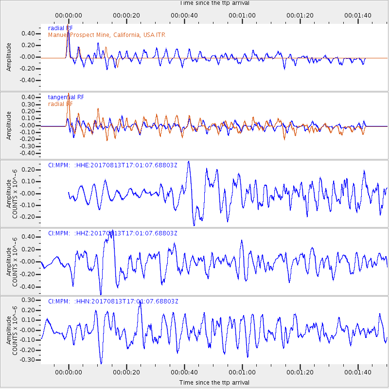
MPM Manuel Prospect Mine, California, USA - Earthquake Result Viewer
*The percent match for this event was below the threshold and hence no stack was calculated.
| Earthquake location: |
Central Peru |
| Earthquake latitude/longitude: |
-10.7/-74.6 |
| Earthquake time(UTC): |
2017/08/13 (225) 16:51:22 GMT |
| Earthquake Depth: |
21 km |
| Earthquake Magnitude: |
5.6 mb |
| Earthquake Catalog/Contributor: |
NEIC PDE/us |
|
| Network: |
CI Caltech Regional Seismic Network |
| Station: |
MPM Manuel Prospect Mine, California, USA |
| Lat/Lon: |
36.06 N/117.49 W |
| Elevation: |
185 m |
|
| Distance: |
61.6 deg |
| Az: |
321.165 deg |
| Baz: |
130.485 deg |
| Ray Param: |
$rayparam |
*The percent match for this event was below the threshold and hence was not used in the summary stack. |
|
| Radial Match: |
72.692055 % |
| Radial Bump: |
400 |
| Transverse Match: |
63.040493 % |
| Transverse Bump: |
400 |
| SOD ConfigId: |
13570011 |
| Insert Time: |
2019-04-28 14:22:03.052 +0000 |
| GWidth: |
2.5 |
| Max Bumps: |
400 |
| Tol: |
0.001 |
|
Signal To Noise
| Channel | StoN | STA | LTA |
| CI:MPM: :HHZ:20170813T17:01:07.68803Z | 2.7148902 | 1.5162306E-7 | 5.5848687E-8 |
| CI:MPM: :HHN:20170813T17:01:07.68803Z | 1.1992496 | 6.494746E-8 | 5.4156743E-8 |
| CI:MPM: :HHE:20170813T17:01:07.68803Z | 0.7791219 | 3.9069747E-8 | 5.014587E-8 |
| Arrivals |
| Ps | |
| PpPs | |
| PsPs/PpSs | |


