You are here: Home > Network List > CI - Caltech Regional Seismic Network Stations List
> Station SWS Sam W. Stewart, Westmorland, CA, USA > Earthquake Result Viewer
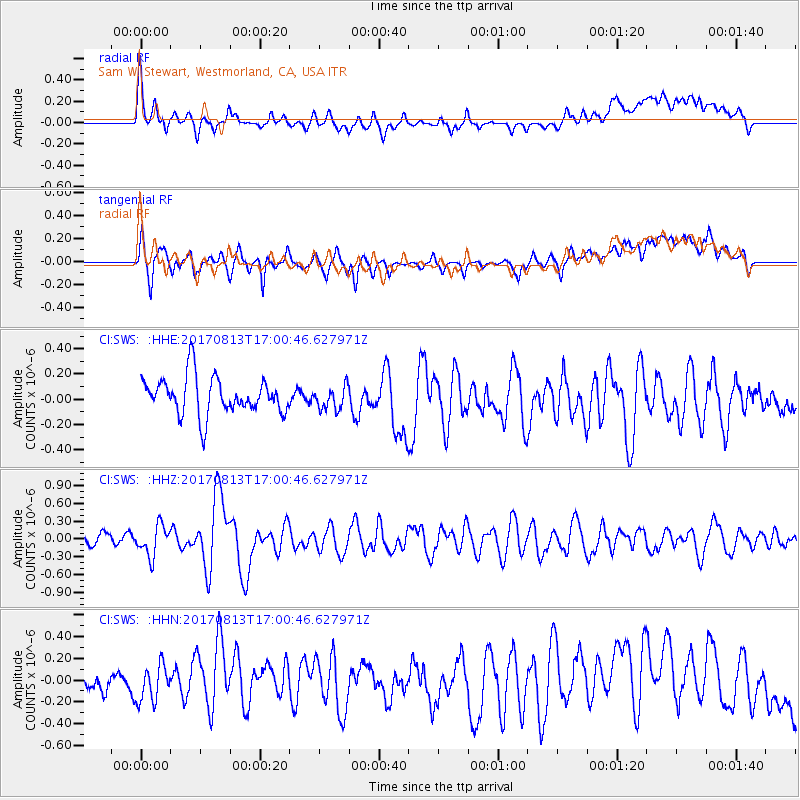
SWS Sam W. Stewart, Westmorland, CA, USA - Earthquake Result Viewer
*The percent match for this event was below the threshold and hence no stack was calculated.
| Earthquake location: |
Central Peru |
| Earthquake latitude/longitude: |
-10.7/-74.6 |
| Earthquake time(UTC): |
2017/08/13 (225) 16:51:22 GMT |
| Earthquake Depth: |
21 km |
| Earthquake Magnitude: |
5.6 mb |
| Earthquake Catalog/Contributor: |
NEIC PDE/us |
|
| Network: |
CI Caltech Regional Seismic Network |
| Station: |
SWS Sam W. Stewart, Westmorland, CA, USA |
| Lat/Lon: |
32.94 N/115.80 W |
| Elevation: |
140 m |
|
| Distance: |
58.6 deg |
| Az: |
319.489 deg |
| Baz: |
130.603 deg |
| Ray Param: |
$rayparam |
*The percent match for this event was below the threshold and hence was not used in the summary stack. |
|
| Radial Match: |
60.1092 % |
| Radial Bump: |
400 |
| Transverse Match: |
59.652004 % |
| Transverse Bump: |
400 |
| SOD ConfigId: |
13570011 |
| Insert Time: |
2019-04-28 14:22:13.587 +0000 |
| GWidth: |
2.5 |
| Max Bumps: |
400 |
| Tol: |
0.001 |
|
Signal To Noise
| Channel | StoN | STA | LTA |
| CI:SWS: :HHZ:20170813T17:00:46.627971Z | 2.1406434 | 2.5437328E-7 | 1.1883029E-7 |
| CI:SWS: :HHN:20170813T17:00:46.627971Z | 1.0905237 | 1.702044E-7 | 1.5607586E-7 |
| CI:SWS: :HHE:20170813T17:00:46.627971Z | 0.6270436 | 9.2017906E-8 | 1.4674882E-7 |
| Arrivals |
| Ps | |
| PpPs | |
| PsPs/PpSs | |


