You are here: Home > Network List > TA - USArray Transportable Network (new EarthScope stations) Stations List
> Station N23A Red Feather Lakes, CO, USA > Earthquake Result Viewer
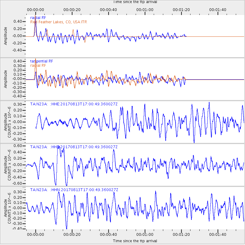
N23A Red Feather Lakes, CO, USA - Earthquake Result Viewer
*The percent match for this event was below the threshold and hence no stack was calculated.
| Earthquake location: |
Central Peru |
| Earthquake latitude/longitude: |
-10.7/-74.6 |
| Earthquake time(UTC): |
2017/08/13 (225) 16:51:22 GMT |
| Earthquake Depth: |
21 km |
| Earthquake Magnitude: |
5.6 mb |
| Earthquake Catalog/Contributor: |
NEIC PDE/us |
|
| Network: |
TA USArray Transportable Network (new EarthScope stations) |
| Station: |
N23A Red Feather Lakes, CO, USA |
| Lat/Lon: |
40.89 N/105.94 W |
| Elevation: |
2458 m |
|
| Distance: |
59.0 deg |
| Az: |
332.567 deg |
| Baz: |
143.324 deg |
| Ray Param: |
$rayparam |
*The percent match for this event was below the threshold and hence was not used in the summary stack. |
|
| Radial Match: |
72.925064 % |
| Radial Bump: |
400 |
| Transverse Match: |
64.46275 % |
| Transverse Bump: |
400 |
| SOD ConfigId: |
13570011 |
| Insert Time: |
2019-04-28 14:27:10.899 +0000 |
| GWidth: |
2.5 |
| Max Bumps: |
400 |
| Tol: |
0.001 |
|
Signal To Noise
| Channel | StoN | STA | LTA |
| TA:N23A: :HHZ:20170813T17:00:49.360027Z | 3.1241379 | 1.8731102E-7 | 5.9956065E-8 |
| TA:N23A: :HHN:20170813T17:00:49.360027Z | 1.0986648 | 6.1623886E-8 | 5.6089807E-8 |
| TA:N23A: :HHE:20170813T17:00:49.360027Z | 0.84302366 | 4.620581E-8 | 5.4809625E-8 |
| Arrivals |
| Ps | |
| PpPs | |
| PsPs/PpSs | |


