You are here: Home > Network List > UW - Pacific Northwest Regional Seismic Network Stations List
> Station FISH Seaside, OR, USA > Earthquake Result Viewer
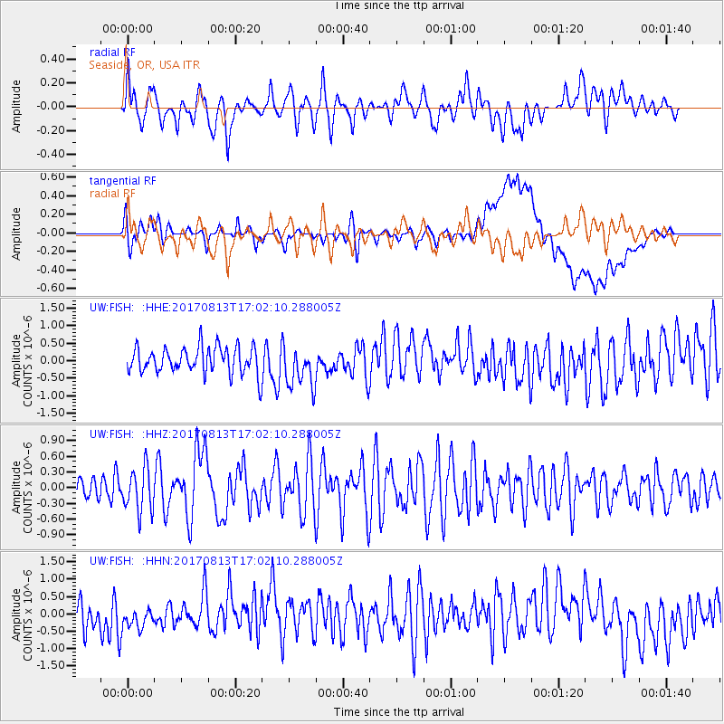
FISH Seaside, OR, USA - Earthquake Result Viewer
*The percent match for this event was below the threshold and hence no stack was calculated.
| Earthquake location: |
Central Peru |
| Earthquake latitude/longitude: |
-10.7/-74.6 |
| Earthquake time(UTC): |
2017/08/13 (225) 16:51:22 GMT |
| Earthquake Depth: |
21 km |
| Earthquake Magnitude: |
5.6 mb |
| Earthquake Catalog/Contributor: |
NEIC PDE/us |
|
| Network: |
UW Pacific Northwest Regional Seismic Network |
| Station: |
FISH Seaside, OR, USA |
| Lat/Lon: |
45.93 N/123.56 W |
| Elevation: |
325 m |
|
| Distance: |
71.5 deg |
| Az: |
326.255 deg |
| Baz: |
128.534 deg |
| Ray Param: |
$rayparam |
*The percent match for this event was below the threshold and hence was not used in the summary stack. |
|
| Radial Match: |
57.26995 % |
| Radial Bump: |
400 |
| Transverse Match: |
44.43719 % |
| Transverse Bump: |
400 |
| SOD ConfigId: |
13570011 |
| Insert Time: |
2019-04-28 14:28:06.543 +0000 |
| GWidth: |
2.5 |
| Max Bumps: |
400 |
| Tol: |
0.001 |
|
Signal To Noise
| Channel | StoN | STA | LTA |
| UW:FISH: :HHZ:20170813T17:02:10.288005Z | 1.16322 | 4.2007218E-7 | 3.6112874E-7 |
| UW:FISH: :HHN:20170813T17:02:10.288005Z | 0.85906357 | 3.4484378E-7 | 4.0141825E-7 |
| UW:FISH: :HHE:20170813T17:02:10.288005Z | 1.5790442 | 6.0286567E-7 | 3.817915E-7 |
| Arrivals |
| Ps | |
| PpPs | |
| PsPs/PpSs | |


