You are here: Home > Network List > AK - Alaska Regional Network Stations List
> Station CUT Chulitna, AK, USA > Earthquake Result Viewer
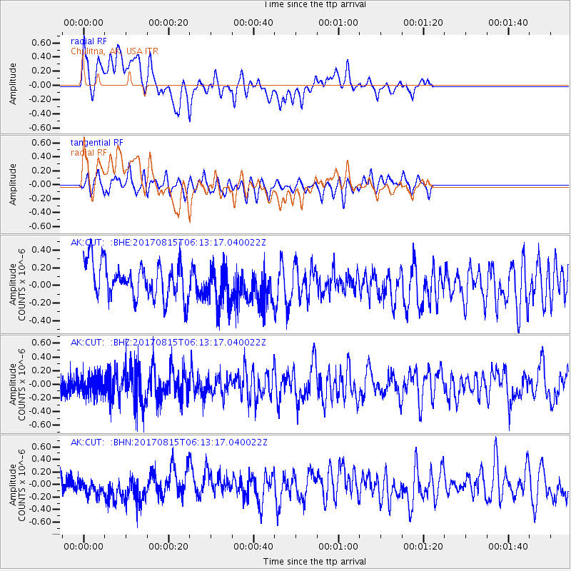
CUT Chulitna, AK, USA - Earthquake Result Viewer
*The percent match for this event was below the threshold and hence no stack was calculated.
| Earthquake location: |
Samoa Islands Region |
| Earthquake latitude/longitude: |
-14.8/-173.1 |
| Earthquake time(UTC): |
2017/08/15 (227) 06:01:44 GMT |
| Earthquake Depth: |
10 km |
| Earthquake Magnitude: |
5.2 mb |
| Earthquake Catalog/Contributor: |
NEIC PDE/us |
|
| Network: |
AK Alaska Regional Network |
| Station: |
CUT Chulitna, AK, USA |
| Lat/Lon: |
62.41 N/150.26 W |
| Elevation: |
574 m |
|
| Distance: |
79.0 deg |
| Az: |
10.597 deg |
| Baz: |
202.456 deg |
| Ray Param: |
$rayparam |
*The percent match for this event was below the threshold and hence was not used in the summary stack. |
|
| Radial Match: |
59.339428 % |
| Radial Bump: |
400 |
| Transverse Match: |
52.27847 % |
| Transverse Bump: |
400 |
| SOD ConfigId: |
13570011 |
| Insert Time: |
2019-04-28 14:38:05.850 +0000 |
| GWidth: |
2.5 |
| Max Bumps: |
400 |
| Tol: |
0.001 |
|
Signal To Noise
| Channel | StoN | STA | LTA |
| AK:CUT: :BHZ:20170815T06:13:17.040022Z | 1.3448901 | 1.3823733E-7 | 1.0278708E-7 |
| AK:CUT: :BHN:20170815T06:13:17.040022Z | 0.7544448 | 1.6678744E-7 | 2.210731E-7 |
| AK:CUT: :BHE:20170815T06:13:17.040022Z | 1.0996445 | 2.1910772E-7 | 1.9925322E-7 |
| Arrivals |
| Ps | |
| PpPs | |
| PsPs/PpSs | |


