You are here: Home > Network List > AK - Alaska Regional Network Stations List
> Station CUT Chulitna, AK, USA > Earthquake Result Viewer
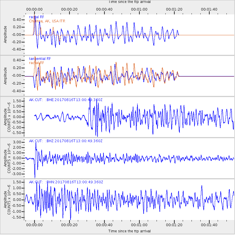
CUT Chulitna, AK, USA - Earthquake Result Viewer
*The percent match for this event was below the threshold and hence no stack was calculated.
| Earthquake location: |
Northwest Of Ryukyu Islands |
| Earthquake latitude/longitude: |
28.6/127.9 |
| Earthquake time(UTC): |
2017/08/16 (228) 12:51:25 GMT |
| Earthquake Depth: |
197 km |
| Earthquake Magnitude: |
5.7 Mww |
| Earthquake Catalog/Contributor: |
NEIC PDE/us |
|
| Network: |
AK Alaska Regional Network |
| Station: |
CUT Chulitna, AK, USA |
| Lat/Lon: |
62.41 N/150.26 W |
| Elevation: |
574 m |
|
| Distance: |
61.3 deg |
| Az: |
31.702 deg |
| Baz: |
277.293 deg |
| Ray Param: |
$rayparam |
*The percent match for this event was below the threshold and hence was not used in the summary stack. |
|
| Radial Match: |
68.76691 % |
| Radial Bump: |
400 |
| Transverse Match: |
59.94209 % |
| Transverse Bump: |
400 |
| SOD ConfigId: |
13570011 |
| Insert Time: |
2019-04-28 14:51:04.507 +0000 |
| GWidth: |
2.5 |
| Max Bumps: |
400 |
| Tol: |
0.001 |
|
Signal To Noise
| Channel | StoN | STA | LTA |
| AK:CUT: :BHZ:20170816T13:00:49.360Z | 14.470141 | 1.3865144E-6 | 9.5819E-8 |
| AK:CUT: :BHN:20170816T13:00:49.360Z | 3.8457518 | 6.8353575E-7 | 1.7773787E-7 |
| AK:CUT: :BHE:20170816T13:00:49.360Z | 4.1864905 | 7.946745E-7 | 1.8981879E-7 |
| Arrivals |
| Ps | |
| PpPs | |
| PsPs/PpSs | |


