You are here: Home > Network List > US - United States National Seismic Network Stations List
> Station HLID Hailey, Idaho, USA > Earthquake Result Viewer
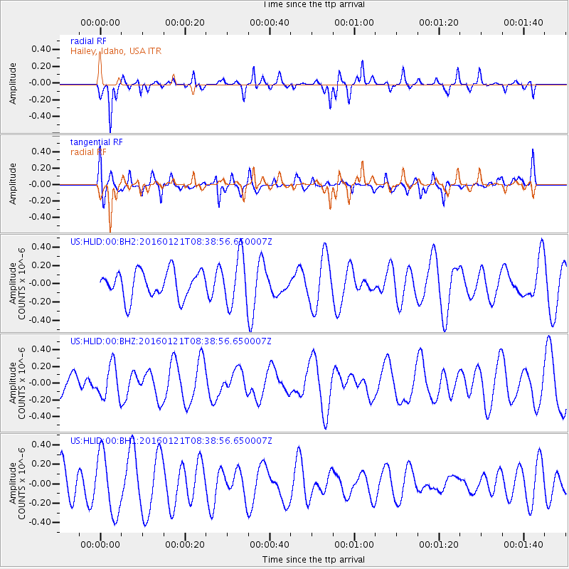
HLID Hailey, Idaho, USA - Earthquake Result Viewer
*The percent match for this event was below the threshold and hence no stack was calculated.
| Earthquake location: |
Kermadec Islands, New Zealand |
| Earthquake latitude/longitude: |
-30.9/-178.6 |
| Earthquake time(UTC): |
2016/01/21 (021) 08:26:21 GMT |
| Earthquake Depth: |
123 km |
| Earthquake Magnitude: |
5.5 MWC, 5.5 MWC |
| Earthquake Catalog/Contributor: |
NEIC PDE/NEIC COMCAT |
|
| Network: |
US United States National Seismic Network |
| Station: |
HLID Hailey, Idaho, USA |
| Lat/Lon: |
43.56 N/114.41 W |
| Elevation: |
1772 m |
|
| Distance: |
94.5 deg |
| Az: |
41.022 deg |
| Baz: |
230.915 deg |
| Ray Param: |
$rayparam |
*The percent match for this event was below the threshold and hence was not used in the summary stack. |
|
| Radial Match: |
58.80036 % |
| Radial Bump: |
247 |
| Transverse Match: |
47.446674 % |
| Transverse Bump: |
400 |
| SOD ConfigId: |
1399611 |
| Insert Time: |
2016-02-10 12:22:47.985 +0000 |
| GWidth: |
2.5 |
| Max Bumps: |
400 |
| Tol: |
0.001 |
|
Signal To Noise
| Channel | StoN | STA | LTA |
| US:HLID:00:BHZ:20160121T08:38:56.650007Z | 1.0075502 | 2.0197496E-7 | 2.0046141E-7 |
| US:HLID:00:BH1:20160121T08:38:56.650007Z | 2.0120375 | 3.18577E-7 | 1.5833554E-7 |
| US:HLID:00:BH2:20160121T08:38:56.650007Z | 1.8946587 | 2.759463E-7 | 1.4564434E-7 |
| Arrivals |
| Ps | |
| PpPs | |
| PsPs/PpSs | |


