You are here: Home > Network List > AV - Alaska Volcano Observatory Stations List
> Station SPU Mount Spurr, Mount Spurr, Alaska > Earthquake Result Viewer
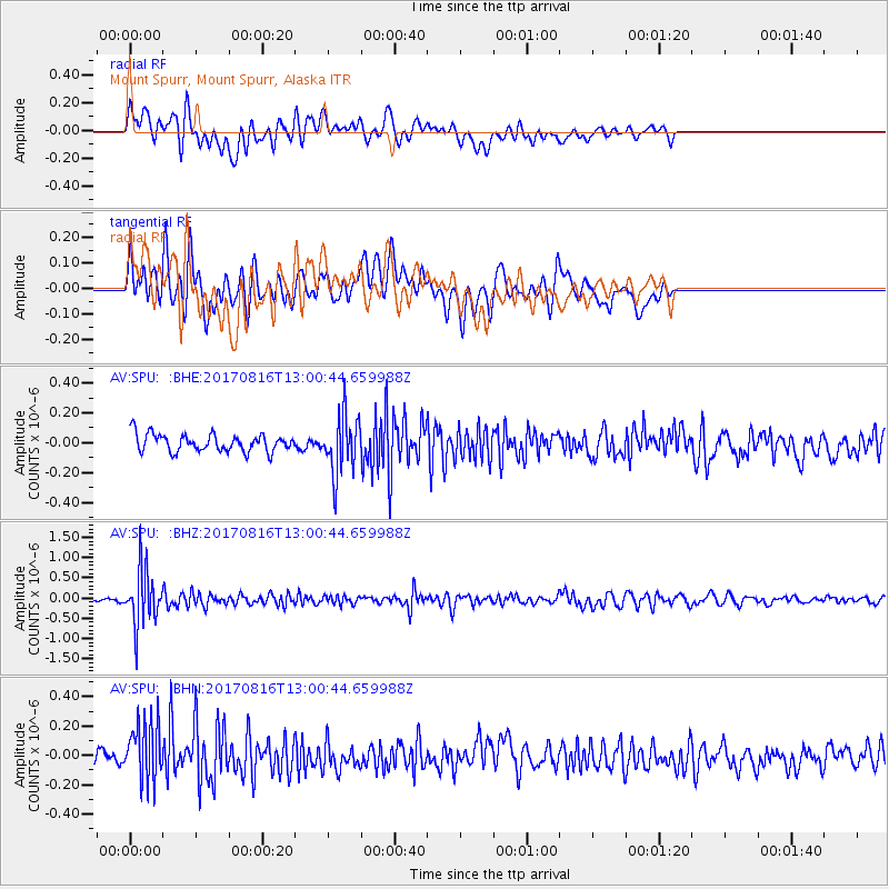
SPU Mount Spurr, Mount Spurr, Alaska - Earthquake Result Viewer
*The percent match for this event was below the threshold and hence no stack was calculated.
| Earthquake location: |
Northwest Of Ryukyu Islands |
| Earthquake latitude/longitude: |
28.6/127.9 |
| Earthquake time(UTC): |
2017/08/16 (228) 12:51:25 GMT |
| Earthquake Depth: |
197 km |
| Earthquake Magnitude: |
5.7 Mww |
| Earthquake Catalog/Contributor: |
NEIC PDE/us |
|
| Network: |
AV Alaska Volcano Observatory |
| Station: |
SPU Mount Spurr, Mount Spurr, Alaska |
| Lat/Lon: |
61.18 N/152.06 W |
| Elevation: |
800 m |
|
| Distance: |
60.6 deg |
| Az: |
33.215 deg |
| Baz: |
276.449 deg |
| Ray Param: |
$rayparam |
*The percent match for this event was below the threshold and hence was not used in the summary stack. |
|
| Radial Match: |
61.30718 % |
| Radial Bump: |
400 |
| Transverse Match: |
54.207623 % |
| Transverse Bump: |
400 |
| SOD ConfigId: |
13570011 |
| Insert Time: |
2019-04-28 14:52:48.058 +0000 |
| GWidth: |
2.5 |
| Max Bumps: |
400 |
| Tol: |
0.001 |
|
Signal To Noise
| Channel | StoN | STA | LTA |
| AV:SPU: :BHZ:20170816T13:00:44.659988Z | 16.687666 | 6.8134676E-7 | 4.0829363E-8 |
| AV:SPU: :BHN:20170816T13:00:44.659988Z | 3.8015585 | 2.1288758E-7 | 5.6000083E-8 |
| AV:SPU: :BHE:20170816T13:00:44.659988Z | 3.316315 | 1.9301493E-7 | 5.820163E-8 |
| Arrivals |
| Ps | |
| PpPs | |
| PsPs/PpSs | |


