You are here: Home > Network List > CI - Caltech Regional Seismic Network Stations List
> Station DGR Domenigoni Reservoir, California, USA > Earthquake Result Viewer
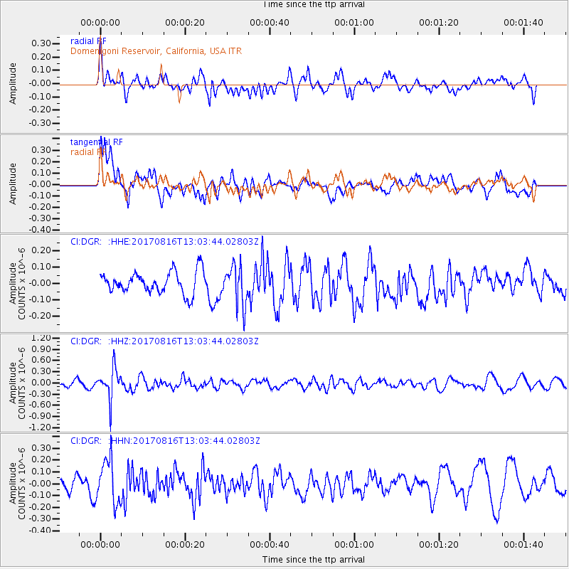
DGR Domenigoni Reservoir, California, USA - Earthquake Result Viewer
*The percent match for this event was below the threshold and hence no stack was calculated.
| Earthquake location: |
Northwest Of Ryukyu Islands |
| Earthquake latitude/longitude: |
28.6/127.9 |
| Earthquake time(UTC): |
2017/08/16 (228) 12:51:25 GMT |
| Earthquake Depth: |
197 km |
| Earthquake Magnitude: |
5.7 Mww |
| Earthquake Catalog/Contributor: |
NEIC PDE/us |
|
| Network: |
CI Caltech Regional Seismic Network |
| Station: |
DGR Domenigoni Reservoir, California, USA |
| Lat/Lon: |
33.65 N/117.01 W |
| Elevation: |
609 m |
|
| Distance: |
92.7 deg |
| Az: |
49.151 deg |
| Baz: |
307.15 deg |
| Ray Param: |
$rayparam |
*The percent match for this event was below the threshold and hence was not used in the summary stack. |
|
| Radial Match: |
51.92333 % |
| Radial Bump: |
400 |
| Transverse Match: |
66.917366 % |
| Transverse Bump: |
400 |
| SOD ConfigId: |
13570011 |
| Insert Time: |
2019-04-28 14:53:25.727 +0000 |
| GWidth: |
2.5 |
| Max Bumps: |
400 |
| Tol: |
0.001 |
|
Signal To Noise
| Channel | StoN | STA | LTA |
| CI:DGR: :HHZ:20170816T13:03:44.02803Z | 5.861656 | 4.0828056E-7 | 6.9652764E-8 |
| CI:DGR: :HHN:20170816T13:03:44.02803Z | 2.5276687 | 1.8770459E-7 | 7.4259965E-8 |
| CI:DGR: :HHE:20170816T13:03:44.02803Z | 1.7901558 | 1.18580985E-7 | 6.6240595E-8 |
| Arrivals |
| Ps | |
| PpPs | |
| PsPs/PpSs | |


