You are here: Home > Network List > CI - Caltech Regional Seismic Network Stations List
> Station MPP McPhearson Peak > Earthquake Result Viewer
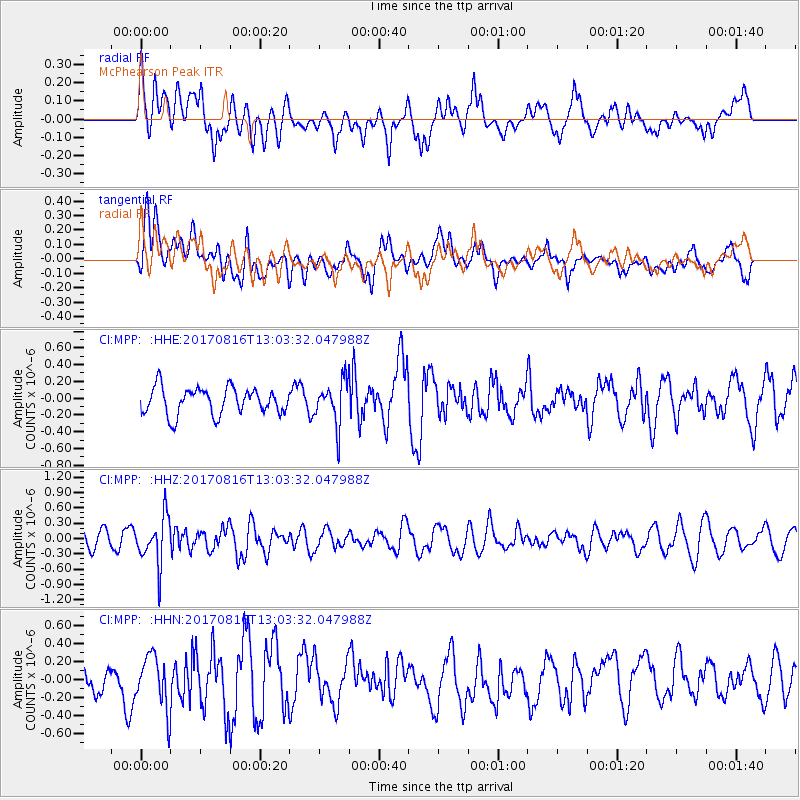
MPP McPhearson Peak - Earthquake Result Viewer
*The percent match for this event was below the threshold and hence no stack was calculated.
| Earthquake location: |
Northwest Of Ryukyu Islands |
| Earthquake latitude/longitude: |
28.6/127.9 |
| Earthquake time(UTC): |
2017/08/16 (228) 12:51:25 GMT |
| Earthquake Depth: |
197 km |
| Earthquake Magnitude: |
5.7 Mww |
| Earthquake Catalog/Contributor: |
NEIC PDE/us |
|
| Network: |
CI Caltech Regional Seismic Network |
| Station: |
MPP McPhearson Peak |
| Lat/Lon: |
34.89 N/119.81 W |
| Elevation: |
1739 m |
|
| Distance: |
90.1 deg |
| Az: |
49.534 deg |
| Baz: |
305.569 deg |
| Ray Param: |
$rayparam |
*The percent match for this event was below the threshold and hence was not used in the summary stack. |
|
| Radial Match: |
54.730087 % |
| Radial Bump: |
400 |
| Transverse Match: |
43.957417 % |
| Transverse Bump: |
400 |
| SOD ConfigId: |
13570011 |
| Insert Time: |
2019-04-28 14:53:40.625 +0000 |
| GWidth: |
2.5 |
| Max Bumps: |
400 |
| Tol: |
0.001 |
|
Signal To Noise
| Channel | StoN | STA | LTA |
| CI:MPP: :HHZ:20170816T13:03:32.047988Z | 2.0499089 | 4.6486346E-7 | 2.2677273E-7 |
| CI:MPP: :HHN:20170816T13:03:32.047988Z | 1.7095743 | 2.988939E-7 | 1.7483526E-7 |
| CI:MPP: :HHE:20170816T13:03:32.047988Z | 1.6108317 | 2.5812653E-7 | 1.6024426E-7 |
| Arrivals |
| Ps | |
| PpPs | |
| PsPs/PpSs | |


