You are here: Home > Network List > CI - Caltech Regional Seismic Network Stations List
> Station SMM Simmler, CA, USA > Earthquake Result Viewer
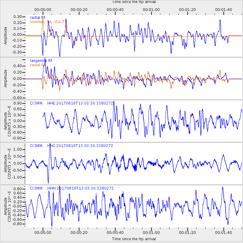
SMM Simmler, CA, USA - Earthquake Result Viewer
*The percent match for this event was below the threshold and hence no stack was calculated.
| Earthquake location: |
Northwest Of Ryukyu Islands |
| Earthquake latitude/longitude: |
28.6/127.9 |
| Earthquake time(UTC): |
2017/08/16 (228) 12:51:25 GMT |
| Earthquake Depth: |
197 km |
| Earthquake Magnitude: |
5.7 Mww |
| Earthquake Catalog/Contributor: |
NEIC PDE/us |
|
| Network: |
CI Caltech Regional Seismic Network |
| Station: |
SMM Simmler, CA, USA |
| Lat/Lon: |
35.31 N/120.00 W |
| Elevation: |
599 m |
|
| Distance: |
89.8 deg |
| Az: |
49.275 deg |
| Baz: |
305.464 deg |
| Ray Param: |
$rayparam |
*The percent match for this event was below the threshold and hence was not used in the summary stack. |
|
| Radial Match: |
48.93543 % |
| Radial Bump: |
400 |
| Transverse Match: |
67.440834 % |
| Transverse Bump: |
400 |
| SOD ConfigId: |
13570011 |
| Insert Time: |
2019-04-28 14:53:50.414 +0000 |
| GWidth: |
2.5 |
| Max Bumps: |
400 |
| Tol: |
0.001 |
|
Signal To Noise
| Channel | StoN | STA | LTA |
| CI:SMM: :HHZ:20170816T13:03:30.338027Z | 2.886628 | 6.051539E-7 | 2.0964043E-7 |
| CI:SMM: :HHN:20170816T13:03:30.338027Z | 1.0073559 | 3.3056207E-7 | 3.2814825E-7 |
| CI:SMM: :HHE:20170816T13:03:30.338027Z | 0.9773078 | 2.8795807E-7 | 2.946442E-7 |
| Arrivals |
| Ps | |
| PpPs | |
| PsPs/PpSs | |


