You are here: Home > Network List > MN - MEDNET Project Stations List
> Station VTS Vitosha, Bulgary > Earthquake Result Viewer
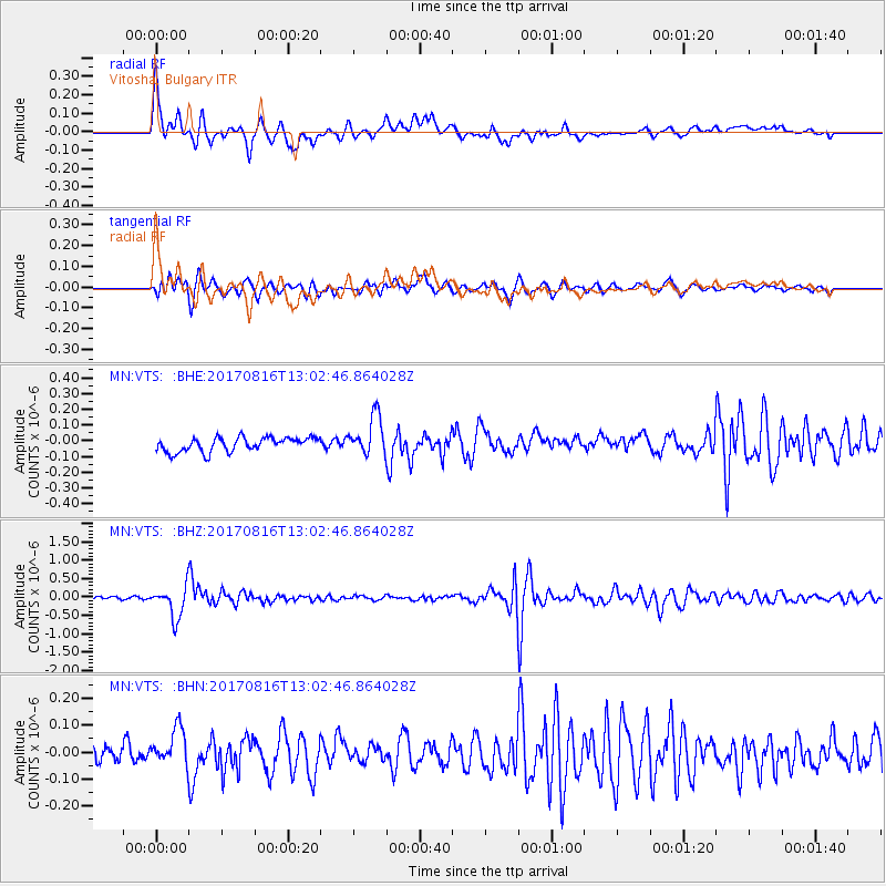
VTS Vitosha, Bulgary - Earthquake Result Viewer
*The percent match for this event was below the threshold and hence no stack was calculated.
| Earthquake location: |
Northwest Of Ryukyu Islands |
| Earthquake latitude/longitude: |
28.6/127.9 |
| Earthquake time(UTC): |
2017/08/16 (228) 12:51:25 GMT |
| Earthquake Depth: |
197 km |
| Earthquake Magnitude: |
5.7 Mww |
| Earthquake Catalog/Contributor: |
NEIC PDE/us |
|
| Network: |
MN MEDNET Project |
| Station: |
VTS Vitosha, Bulgary |
| Lat/Lon: |
42.62 N/23.24 E |
| Elevation: |
1490 m |
|
| Distance: |
81.0 deg |
| Az: |
313.696 deg |
| Baz: |
59.42 deg |
| Ray Param: |
$rayparam |
*The percent match for this event was below the threshold and hence was not used in the summary stack. |
|
| Radial Match: |
71.390434 % |
| Radial Bump: |
400 |
| Transverse Match: |
76.41252 % |
| Transverse Bump: |
400 |
| SOD ConfigId: |
13570011 |
| Insert Time: |
2019-04-28 14:56:01.494 +0000 |
| GWidth: |
2.5 |
| Max Bumps: |
400 |
| Tol: |
0.001 |
|
Signal To Noise
| Channel | StoN | STA | LTA |
| MN:VTS: :BHZ:20170816T13:02:46.864028Z | 11.43793 | 4.22535E-7 | 3.694156E-8 |
| MN:VTS: :BHN:20170816T13:02:46.864028Z | 1.9548914 | 7.078168E-8 | 3.620747E-8 |
| MN:VTS: :BHE:20170816T13:02:46.864028Z | 2.7995553 | 1.2497524E-7 | 4.464111E-8 |
| Arrivals |
| Ps | |
| PpPs | |
| PsPs/PpSs | |


