You are here: Home > Network List > TA - USArray Transportable Network (new EarthScope stations) Stations List
> Station 425A Indio Mountain, Van Horn, TX, USA > Earthquake Result Viewer
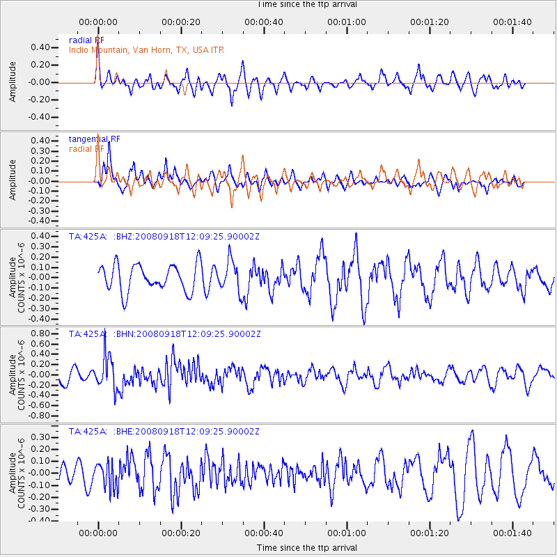
425A Indio Mountain, Van Horn, TX, USA - Earthquake Result Viewer
*The percent match for this event was below the threshold and hence no stack was calculated.
| Earthquake location: |
Near East Coast Of Kamchatka |
| Earthquake latitude/longitude: |
51.9/158.4 |
| Earthquake time(UTC): |
2008/09/18 (262) 11:58:50 GMT |
| Earthquake Depth: |
67 km |
| Earthquake Magnitude: |
5.7 MB, 5.9 MW, 5.8 MW |
| Earthquake Catalog/Contributor: |
WHDF/NEIC |
|
| Network: |
TA USArray Transportable Network (new EarthScope stations) |
| Station: |
425A Indio Mountain, Van Horn, TX, USA |
| Lat/Lon: |
30.79 N/104.99 W |
| Elevation: |
1337 m |
|
| Distance: |
70.2 deg |
| Az: |
65.287 deg |
| Baz: |
319.176 deg |
| Ray Param: |
$rayparam |
*The percent match for this event was below the threshold and hence was not used in the summary stack. |
|
| Radial Match: |
65.68045 % |
| Radial Bump: |
400 |
| Transverse Match: |
78.19034 % |
| Transverse Bump: |
356 |
| SOD ConfigId: |
2560 |
| Insert Time: |
2010-03-06 02:55:02.934 +0000 |
| GWidth: |
2.5 |
| Max Bumps: |
400 |
| Tol: |
0.001 |
|
Signal To Noise
| Channel | StoN | STA | LTA |
| TA:425A: :BHN:20080918T12:09:25.90002Z | 2.3556676 | 3.3280676E-7 | 1.4127916E-7 |
| TA:425A: :BHE:20080918T12:09:25.90002Z | 1.370845 | 1.067086E-7 | 7.784147E-8 |
| TA:425A: :BHZ:20080918T12:09:25.90002Z | 1.2082529 | 1.5561554E-7 | 1.2879384E-7 |
| Arrivals |
| Ps | |
| PpPs | |
| PsPs/PpSs | |


