You are here: Home > Network List > TA - USArray Transportable Network (new EarthScope stations) Stations List
> Station 425A Indio Mountain, Van Horn, TX, USA > Earthquake Result Viewer
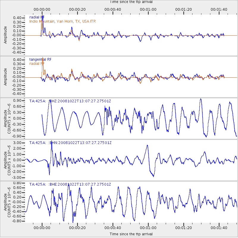
425A Indio Mountain, Van Horn, TX, USA - Earthquake Result Viewer
*The percent match for this event was below the threshold and hence no stack was calculated.
| Earthquake location: |
Tonga Islands |
| Earthquake latitude/longitude: |
-18.4/-175.4 |
| Earthquake time(UTC): |
2008/10/22 (296) 12:55:57 GMT |
| Earthquake Depth: |
233 km |
| Earthquake Magnitude: |
5.9 MB, 6.4 MW, 6.3 MW |
| Earthquake Catalog/Contributor: |
WHDF/NEIC |
|
| Network: |
TA USArray Transportable Network (new EarthScope stations) |
| Station: |
425A Indio Mountain, Van Horn, TX, USA |
| Lat/Lon: |
30.79 N/104.99 W |
| Elevation: |
1337 m |
|
| Distance: |
83.4 deg |
| Az: |
54.679 deg |
| Baz: |
244.179 deg |
| Ray Param: |
$rayparam |
*The percent match for this event was below the threshold and hence was not used in the summary stack. |
|
| Radial Match: |
57.57085 % |
| Radial Bump: |
286 |
| Transverse Match: |
55.36714 % |
| Transverse Bump: |
384 |
| SOD ConfigId: |
2560 |
| Insert Time: |
2010-03-06 02:55:04.431 +0000 |
| GWidth: |
2.5 |
| Max Bumps: |
400 |
| Tol: |
0.001 |
|
Signal To Noise
| Channel | StoN | STA | LTA |
| TA:425A: :BHN:20081022T13:07:27.27501Z | 2.6143754 | 6.8470973E-7 | 2.6190185E-7 |
| TA:425A: :BHE:20081022T13:07:27.27501Z | 0.854417 | 2.5336993E-7 | 2.9654132E-7 |
| TA:425A: :BHZ:20081022T13:07:27.27501Z | 0.81761175 | 3.538891E-7 | 4.328327E-7 |
| Arrivals |
| Ps | |
| PpPs | |
| PsPs/PpSs | |


