You are here: Home > Network List > TA - USArray Transportable Network (new EarthScope stations) Stations List
> Station 109C Camp Elliot, Mirimar, CA, USA > Earthquake Result Viewer
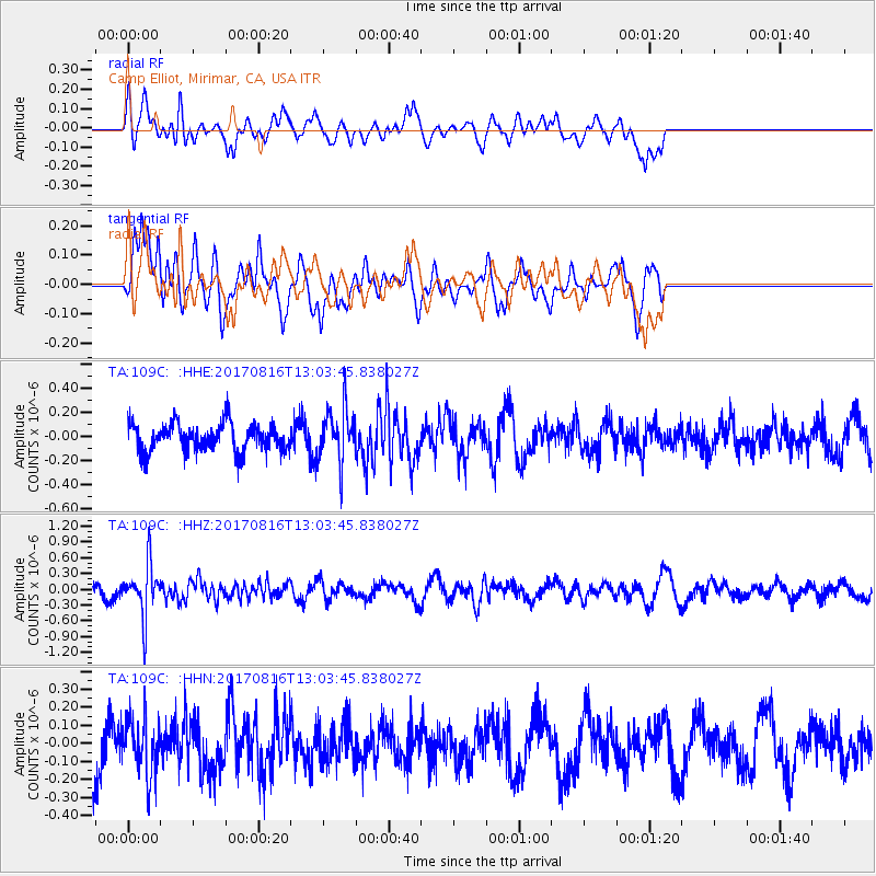
109C Camp Elliot, Mirimar, CA, USA - Earthquake Result Viewer
*The percent match for this event was below the threshold and hence no stack was calculated.
| Earthquake location: |
Northwest Of Ryukyu Islands |
| Earthquake latitude/longitude: |
28.6/127.9 |
| Earthquake time(UTC): |
2017/08/16 (228) 12:51:25 GMT |
| Earthquake Depth: |
197 km |
| Earthquake Magnitude: |
5.7 Mww |
| Earthquake Catalog/Contributor: |
NEIC PDE/us |
|
| Network: |
TA USArray Transportable Network (new EarthScope stations) |
| Station: |
109C Camp Elliot, Mirimar, CA, USA |
| Lat/Lon: |
32.89 N/117.11 W |
| Elevation: |
150 m |
|
| Distance: |
93.1 deg |
| Az: |
49.806 deg |
| Baz: |
307.065 deg |
| Ray Param: |
$rayparam |
*The percent match for this event was below the threshold and hence was not used in the summary stack. |
|
| Radial Match: |
52.580235 % |
| Radial Bump: |
400 |
| Transverse Match: |
72.53869 % |
| Transverse Bump: |
400 |
| SOD ConfigId: |
13570011 |
| Insert Time: |
2019-04-28 14:57:40.065 +0000 |
| GWidth: |
2.5 |
| Max Bumps: |
400 |
| Tol: |
0.001 |
|
Signal To Noise
| Channel | StoN | STA | LTA |
| TA:109C: :HHZ:20170816T13:03:45.838027Z | 4.0747848 | 4.8622854E-7 | 1.1932619E-7 |
| TA:109C: :HHN:20170816T13:03:45.838027Z | 0.9973167 | 1.5087033E-7 | 1.5127625E-7 |
| TA:109C: :HHE:20170816T13:03:45.838027Z | 1.8774383 | 2.171599E-7 | 1.1566819E-7 |
| Arrivals |
| Ps | |
| PpPs | |
| PsPs/PpSs | |


