You are here: Home > Network List > TA - USArray Transportable Network (new EarthScope stations) Stations List
> Station G21K Allakaket, AK, USA > Earthquake Result Viewer
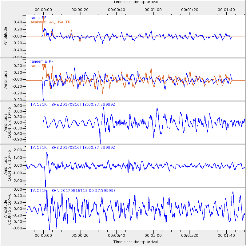
G21K Allakaket, AK, USA - Earthquake Result Viewer
*The percent match for this event was below the threshold and hence no stack was calculated.
| Earthquake location: |
Northwest Of Ryukyu Islands |
| Earthquake latitude/longitude: |
28.6/127.9 |
| Earthquake time(UTC): |
2017/08/16 (228) 12:51:25 GMT |
| Earthquake Depth: |
197 km |
| Earthquake Magnitude: |
5.7 Mww |
| Earthquake Catalog/Contributor: |
NEIC PDE/us |
|
| Network: |
TA USArray Transportable Network (new EarthScope stations) |
| Station: |
G21K Allakaket, AK, USA |
| Lat/Lon: |
66.52 N/153.51 W |
| Elevation: |
446 m |
|
| Distance: |
59.6 deg |
| Az: |
27.107 deg |
| Baz: |
272.098 deg |
| Ray Param: |
$rayparam |
*The percent match for this event was below the threshold and hence was not used in the summary stack. |
|
| Radial Match: |
58.698803 % |
| Radial Bump: |
400 |
| Transverse Match: |
51.738674 % |
| Transverse Bump: |
400 |
| SOD ConfigId: |
13570011 |
| Insert Time: |
2019-04-28 14:58:06.537 +0000 |
| GWidth: |
2.5 |
| Max Bumps: |
400 |
| Tol: |
0.001 |
|
Signal To Noise
| Channel | StoN | STA | LTA |
| TA:G21K: :BHZ:20170816T13:00:37.59999Z | 5.142036 | 9.4718604E-7 | 1.8420447E-7 |
| TA:G21K: :BHN:20170816T13:00:37.59999Z | 2.774377 | 3.0503656E-7 | 1.0994776E-7 |
| TA:G21K: :BHE:20170816T13:00:37.59999Z | 2.8658655 | 4.468616E-7 | 1.5592553E-7 |
| Arrivals |
| Ps | |
| PpPs | |
| PsPs/PpSs | |


