You are here: Home > Network List > TA - USArray Transportable Network (new EarthScope stations) Stations List
> Station L19K White Mountain, AK, USA > Earthquake Result Viewer
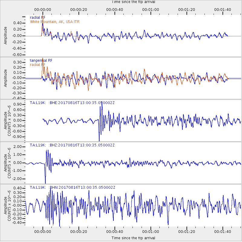
L19K White Mountain, AK, USA - Earthquake Result Viewer
*The percent match for this event was below the threshold and hence no stack was calculated.
| Earthquake location: |
Northwest Of Ryukyu Islands |
| Earthquake latitude/longitude: |
28.6/127.9 |
| Earthquake time(UTC): |
2017/08/16 (228) 12:51:25 GMT |
| Earthquake Depth: |
197 km |
| Earthquake Magnitude: |
5.7 Mww |
| Earthquake Catalog/Contributor: |
NEIC PDE/us |
|
| Network: |
TA USArray Transportable Network (new EarthScope stations) |
| Station: |
L19K White Mountain, AK, USA |
| Lat/Lon: |
62.18 N/154.85 W |
| Elevation: |
650 m |
|
| Distance: |
59.2 deg |
| Az: |
32.192 deg |
| Baz: |
273.476 deg |
| Ray Param: |
$rayparam |
*The percent match for this event was below the threshold and hence was not used in the summary stack. |
|
| Radial Match: |
72.349045 % |
| Radial Bump: |
400 |
| Transverse Match: |
64.443085 % |
| Transverse Bump: |
400 |
| SOD ConfigId: |
13570011 |
| Insert Time: |
2019-04-28 14:58:47.827 +0000 |
| GWidth: |
2.5 |
| Max Bumps: |
400 |
| Tol: |
0.001 |
|
Signal To Noise
| Channel | StoN | STA | LTA |
| TA:L19K: :BHZ:20170816T13:00:35.050002Z | 13.726739 | 8.9346327E-7 | 6.508925E-8 |
| TA:L19K: :BHN:20170816T13:00:35.050002Z | 2.233665 | 1.8660923E-7 | 8.3543966E-8 |
| TA:L19K: :BHE:20170816T13:00:35.050002Z | 5.5256534 | 4.5032758E-7 | 8.149762E-8 |
| Arrivals |
| Ps | |
| PpPs | |
| PsPs/PpSs | |


