You are here: Home > Network List > TA - USArray Transportable Network (new EarthScope stations) Stations List
> Station L20K Farewell, AK, USA > Earthquake Result Viewer
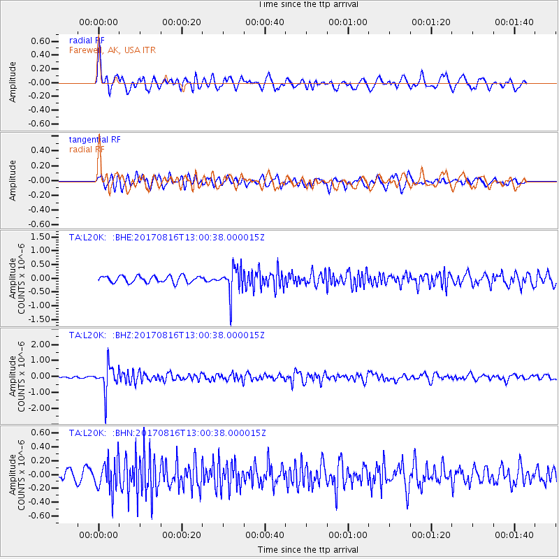
L20K Farewell, AK, USA - Earthquake Result Viewer
*The percent match for this event was below the threshold and hence no stack was calculated.
| Earthquake location: |
Northwest Of Ryukyu Islands |
| Earthquake latitude/longitude: |
28.6/127.9 |
| Earthquake time(UTC): |
2017/08/16 (228) 12:51:25 GMT |
| Earthquake Depth: |
197 km |
| Earthquake Magnitude: |
5.7 Mww |
| Earthquake Catalog/Contributor: |
NEIC PDE/us |
|
| Network: |
TA USArray Transportable Network (new EarthScope stations) |
| Station: |
L20K Farewell, AK, USA |
| Lat/Lon: |
62.48 N/153.88 W |
| Elevation: |
673 m |
|
| Distance: |
59.6 deg |
| Az: |
31.811 deg |
| Baz: |
274.144 deg |
| Ray Param: |
$rayparam |
*The percent match for this event was below the threshold and hence was not used in the summary stack. |
|
| Radial Match: |
69.89422 % |
| Radial Bump: |
400 |
| Transverse Match: |
62.126293 % |
| Transverse Bump: |
400 |
| SOD ConfigId: |
13570011 |
| Insert Time: |
2019-04-28 14:58:48.204 +0000 |
| GWidth: |
2.5 |
| Max Bumps: |
400 |
| Tol: |
0.001 |
|
Signal To Noise
| Channel | StoN | STA | LTA |
| TA:L20K: :BHZ:20170816T13:00:38.000015Z | 18.221718 | 8.5100714E-7 | 4.6702905E-8 |
| TA:L20K: :BHN:20170816T13:00:38.000015Z | 2.213758 | 2.2912859E-7 | 1.0350209E-7 |
| TA:L20K: :BHE:20170816T13:00:38.000015Z | 4.240619 | 5.041096E-7 | 1.18876414E-7 |
| Arrivals |
| Ps | |
| PpPs | |
| PsPs/PpSs | |


