You are here: Home > Network List > TA - USArray Transportable Network (new EarthScope stations) Stations List
> Station TPFO Pinon Flats, CA, USA > Earthquake Result Viewer
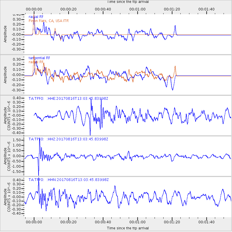
TPFO Pinon Flats, CA, USA - Earthquake Result Viewer
*The percent match for this event was below the threshold and hence no stack was calculated.
| Earthquake location: |
Northwest Of Ryukyu Islands |
| Earthquake latitude/longitude: |
28.6/127.9 |
| Earthquake time(UTC): |
2017/08/16 (228) 12:51:25 GMT |
| Earthquake Depth: |
197 km |
| Earthquake Magnitude: |
5.7 Mww |
| Earthquake Catalog/Contributor: |
NEIC PDE/us |
|
| Network: |
TA USArray Transportable Network (new EarthScope stations) |
| Station: |
TPFO Pinon Flats, CA, USA |
| Lat/Lon: |
33.61 N/116.45 W |
| Elevation: |
1275 m |
|
| Distance: |
93.1 deg |
| Az: |
48.905 deg |
| Baz: |
307.469 deg |
| Ray Param: |
$rayparam |
*The percent match for this event was below the threshold and hence was not used in the summary stack. |
|
| Radial Match: |
54.34725 % |
| Radial Bump: |
400 |
| Transverse Match: |
75.603455 % |
| Transverse Bump: |
400 |
| SOD ConfigId: |
13570011 |
| Insert Time: |
2019-04-28 14:59:42.110 +0000 |
| GWidth: |
2.5 |
| Max Bumps: |
400 |
| Tol: |
0.001 |
|
Signal To Noise
| Channel | StoN | STA | LTA |
| TA:TPFO: :HHZ:20170816T13:03:45.83998Z | 5.713846 | 6.305093E-7 | 1.10347614E-7 |
| TA:TPFO: :HHN:20170816T13:03:45.83998Z | 1.7283553 | 1.5393132E-7 | 8.906231E-8 |
| TA:TPFO: :HHE:20170816T13:03:45.83998Z | 2.629242 | 1.6558008E-7 | 6.2976355E-8 |
| Arrivals |
| Ps | |
| PpPs | |
| PsPs/PpSs | |


