You are here: Home > Network List > TJ - Tajikistan National Seismic Network Stations List
> Station GARM Garm, Tajikistan > Earthquake Result Viewer
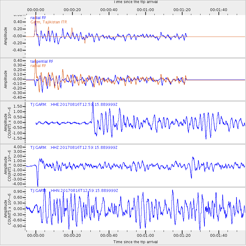
GARM Garm, Tajikistan - Earthquake Result Viewer
*The percent match for this event was below the threshold and hence no stack was calculated.
| Earthquake location: |
Northwest Of Ryukyu Islands |
| Earthquake latitude/longitude: |
28.6/127.9 |
| Earthquake time(UTC): |
2017/08/16 (228) 12:51:25 GMT |
| Earthquake Depth: |
197 km |
| Earthquake Magnitude: |
5.7 Mww |
| Earthquake Catalog/Contributor: |
NEIC PDE/us |
|
| Network: |
TJ Tajikistan National Seismic Network |
| Station: |
GARM Garm, Tajikistan |
| Lat/Lon: |
39.00 N/70.32 E |
| Elevation: |
1305 m |
|
| Distance: |
48.3 deg |
| Az: |
298.132 deg |
| Baz: |
84.113 deg |
| Ray Param: |
$rayparam |
*The percent match for this event was below the threshold and hence was not used in the summary stack. |
|
| Radial Match: |
60.8043 % |
| Radial Bump: |
384 |
| Transverse Match: |
56.86775 % |
| Transverse Bump: |
400 |
| SOD ConfigId: |
13570011 |
| Insert Time: |
2019-04-28 14:59:49.922 +0000 |
| GWidth: |
2.5 |
| Max Bumps: |
400 |
| Tol: |
0.001 |
|
Signal To Noise
| Channel | StoN | STA | LTA |
| TJ:GARM: :HHZ:20170816T12:59:15.889999Z | 26.57357 | 1.4830366E-6 | 5.580871E-8 |
| TJ:GARM: :HHN:20170816T12:59:15.889999Z | 6.6764355 | 4.2047498E-7 | 6.297896E-8 |
| TJ:GARM: :HHE:20170816T12:59:15.889999Z | 12.847844 | 7.707445E-7 | 5.9990185E-8 |
| Arrivals |
| Ps | |
| PpPs | |
| PsPs/PpSs | |


