You are here: Home > Network List > UW - Pacific Northwest Regional Seismic Network Stations List
> Station MRBL Marblemount, WA, USA > Earthquake Result Viewer
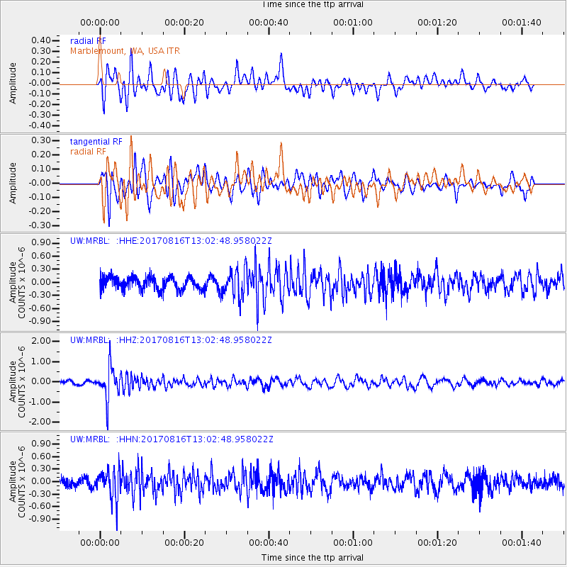
MRBL Marblemount, WA, USA - Earthquake Result Viewer
*The percent match for this event was below the threshold and hence no stack was calculated.
| Earthquake location: |
Northwest Of Ryukyu Islands |
| Earthquake latitude/longitude: |
28.6/127.9 |
| Earthquake time(UTC): |
2017/08/16 (228) 12:51:25 GMT |
| Earthquake Depth: |
197 km |
| Earthquake Magnitude: |
5.7 Mww |
| Earthquake Catalog/Contributor: |
NEIC PDE/us |
|
| Network: |
UW Pacific Northwest Regional Seismic Network |
| Station: |
MRBL Marblemount, WA, USA |
| Lat/Lon: |
48.52 N/121.48 W |
| Elevation: |
75 m |
|
| Distance: |
81.3 deg |
| Az: |
39.02 deg |
| Baz: |
303.666 deg |
| Ray Param: |
$rayparam |
*The percent match for this event was below the threshold and hence was not used in the summary stack. |
|
| Radial Match: |
77.115074 % |
| Radial Bump: |
400 |
| Transverse Match: |
49.609024 % |
| Transverse Bump: |
400 |
| SOD ConfigId: |
13570011 |
| Insert Time: |
2019-04-28 15:00:27.634 +0000 |
| GWidth: |
2.5 |
| Max Bumps: |
400 |
| Tol: |
0.001 |
|
Signal To Noise
| Channel | StoN | STA | LTA |
| UW:MRBL: :HHZ:20170816T13:02:48.958022Z | 7.4429502 | 8.024205E-7 | 1.0780946E-7 |
| UW:MRBL: :HHN:20170816T13:02:48.958022Z | 2.7313888 | 3.5297728E-7 | 1.2922996E-7 |
| UW:MRBL: :HHE:20170816T13:02:48.958022Z | 2.1714115 | 3.1990908E-7 | 1.4732771E-7 |
| Arrivals |
| Ps | |
| PpPs | |
| PsPs/PpSs | |


