You are here: Home > Network List > UW - Pacific Northwest Regional Seismic Network Stations List
> Station YACT Amboy, WA, USA > Earthquake Result Viewer
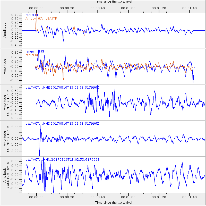
YACT Amboy, WA, USA - Earthquake Result Viewer
*The percent match for this event was below the threshold and hence no stack was calculated.
| Earthquake location: |
Northwest Of Ryukyu Islands |
| Earthquake latitude/longitude: |
28.6/127.9 |
| Earthquake time(UTC): |
2017/08/16 (228) 12:51:25 GMT |
| Earthquake Depth: |
197 km |
| Earthquake Magnitude: |
5.7 Mww |
| Earthquake Catalog/Contributor: |
NEIC PDE/us |
|
| Network: |
UW Pacific Northwest Regional Seismic Network |
| Station: |
YACT Amboy, WA, USA |
| Lat/Lon: |
45.93 N/122.42 W |
| Elevation: |
211 m |
|
| Distance: |
82.2 deg |
| Az: |
41.555 deg |
| Baz: |
303.344 deg |
| Ray Param: |
$rayparam |
*The percent match for this event was below the threshold and hence was not used in the summary stack. |
|
| Radial Match: |
35.194912 % |
| Radial Bump: |
400 |
| Transverse Match: |
69.45456 % |
| Transverse Bump: |
400 |
| SOD ConfigId: |
13570011 |
| Insert Time: |
2019-04-28 15:00:36.930 +0000 |
| GWidth: |
2.5 |
| Max Bumps: |
400 |
| Tol: |
0.001 |
|
Signal To Noise
| Channel | StoN | STA | LTA |
| UW:YACT: :HHZ:20170816T13:02:53.617996Z | 4.9280953 | 8.0700056E-7 | 1.6375506E-7 |
| UW:YACT: :HHN:20170816T13:02:53.617996Z | 0.93546903 | 3.104545E-7 | 3.318704E-7 |
| UW:YACT: :HHE:20170816T13:02:53.617996Z | 1.5508213 | 2.3895868E-7 | 1.5408523E-7 |
| Arrivals |
| Ps | |
| PpPs | |
| PsPs/PpSs | |


