You are here: Home > Network List > TA - USArray Transportable Network (new EarthScope stations) Stations List
> Station L44A Lake County Forest Preserve, Grayslake, IL, USA > Earthquake Result Viewer
L44A Lake County Forest Preserve, Grayslake, IL, USA - Earthquake Result Viewer
*The percent match for this event was below the threshold and hence no stack was calculated.
| Earthquake location: |
North Of Ascension Island |
| Earthquake latitude/longitude: |
-0.9/-13.9 |
| Earthquake time(UTC): |
2017/08/18 (230) 02:59:24 GMT |
| Earthquake Depth: |
19 km |
| Earthquake Magnitude: |
6.7 Mi |
| Earthquake Catalog/Contributor: |
NEIC PDE/pt |
|
| Network: |
TA USArray Transportable Network (new EarthScope stations) |
| Station: |
L44A Lake County Forest Preserve, Grayslake, IL, USA |
| Lat/Lon: |
42.18 N/87.91 W |
| Elevation: |
202 m |
|
| Distance: |
78.8 deg |
| Az: |
313.24 deg |
| Baz: |
101.487 deg |
| Ray Param: |
$rayparam |
*The percent match for this event was below the threshold and hence was not used in the summary stack. |
|
| Radial Match: |
84.41654 % |
| Radial Bump: |
400 |
| Transverse Match: |
51.4189 % |
| Transverse Bump: |
400 |
| SOD ConfigId: |
13570011 |
| Insert Time: |
2019-04-28 15:05:55.352 +0000 |
| GWidth: |
2.5 |
| Max Bumps: |
400 |
| Tol: |
0.001 |
|
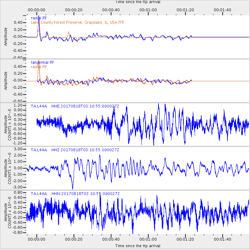
Signal To Noise
| Channel | StoN | STA | LTA |
| TA:L44A: :HHZ:20170818T03:10:55.090027Z | 0.91867334 | 1.5669674E-7 | 1.7056851E-7 |
| TA:L44A: :HHN:20170818T03:10:55.090027Z | 1.2678498 | 3.269651E-7 | 2.5788947E-7 |
| TA:L44A: :HHE:20170818T03:10:55.090027Z | 0.62871176 | 1.6868874E-7 | 2.6830855E-7 |
| Arrivals |
| Ps | |
| PpPs | |
| PsPs/PpSs | |


