You are here: Home > Network List > TA - USArray Transportable Network (new EarthScope stations) Stations List
> Station MDND Maddock, ND, USA > Earthquake Result Viewer
MDND Maddock, ND, USA - Earthquake Result Viewer
*The percent match for this event was below the threshold and hence no stack was calculated.
| Earthquake location: |
Virgin Islands |
| Earthquake latitude/longitude: |
19.2/-64.8 |
| Earthquake time(UTC): |
2008/10/11 (285) 10:40:14 GMT |
| Earthquake Depth: |
23 km |
| Earthquake Magnitude: |
6.1 MB, 5.9 MS, 6.1 MW, 6.0 MW |
| Earthquake Catalog/Contributor: |
WHDF/NEIC |
|
| Network: |
TA USArray Transportable Network (new EarthScope stations) |
| Station: |
MDND Maddock, ND, USA |
| Lat/Lon: |
47.85 N/99.60 W |
| Elevation: |
479 m |
|
| Distance: |
40.2 deg |
| Az: |
323.449 deg |
| Baz: |
123.304 deg |
| Ray Param: |
$rayparam |
*The percent match for this event was below the threshold and hence was not used in the summary stack. |
|
| Radial Match: |
79.33431 % |
| Radial Bump: |
400 |
| Transverse Match: |
70.136505 % |
| Transverse Bump: |
400 |
| SOD ConfigId: |
2556 |
| Insert Time: |
2010-03-06 02:57:45.471 +0000 |
| GWidth: |
2.5 |
| Max Bumps: |
400 |
| Tol: |
0.001 |
|
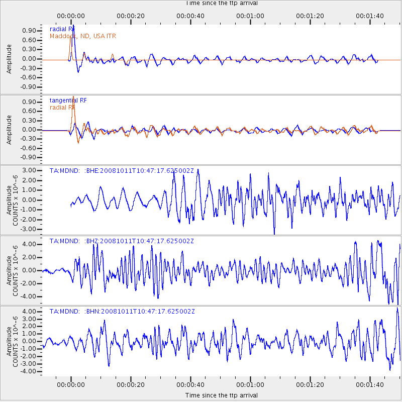
Signal To Noise
| Channel | StoN | STA | LTA |
| TA:MDND: :BHZ:20081011T10:47:17.625002Z | 5.0557003 | 1.2491063E-6 | 2.470689E-7 |
| TA:MDND: :BHN:20081011T10:47:17.625002Z | 0.9191325 | 6.217987E-7 | 6.7650603E-7 |
| TA:MDND: :BHE:20081011T10:47:17.625002Z | 1.9408402 | 1.151346E-6 | 5.9322036E-7 |
| Arrivals |
| Ps | |
| PpPs | |
| PsPs/PpSs | |


