You are here: Home > Network List > TA - USArray Transportable Network (new EarthScope stations) Stations List
> Station MDND Maddock, ND, USA > Earthquake Result Viewer
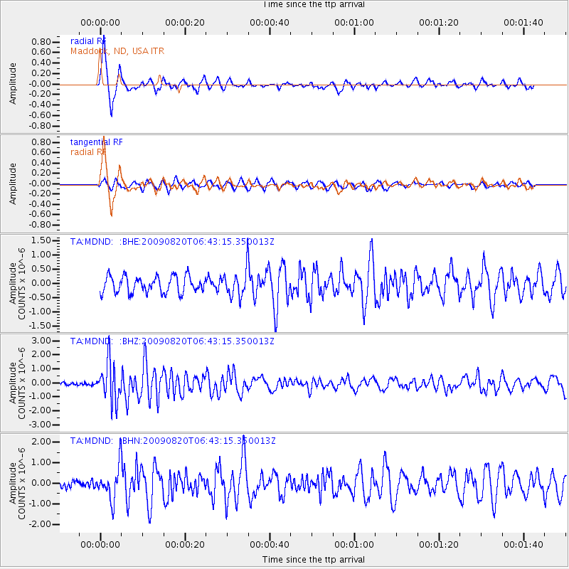
MDND Maddock, ND, USA - Earthquake Result Viewer
*The percent match for this event was below the threshold and hence no stack was calculated.
| Earthquake location: |
Norwegian Sea |
| Earthquake latitude/longitude: |
72.2/0.9 |
| Earthquake time(UTC): |
2009/08/20 (232) 06:35:04 GMT |
| Earthquake Depth: |
6.0 km |
| Earthquake Magnitude: |
5.9 MB, 5.7 MS, 6.0 MW, 6.0 MW |
| Earthquake Catalog/Contributor: |
WHDF/NEIC |
|
| Network: |
TA USArray Transportable Network (new EarthScope stations) |
| Station: |
MDND Maddock, ND, USA |
| Lat/Lon: |
47.85 N/99.60 W |
| Elevation: |
479 m |
|
| Distance: |
48.3 deg |
| Az: |
297.495 deg |
| Baz: |
23.894 deg |
| Ray Param: |
$rayparam |
*The percent match for this event was below the threshold and hence was not used in the summary stack. |
|
| Radial Match: |
78.73721 % |
| Radial Bump: |
342 |
| Transverse Match: |
51.549377 % |
| Transverse Bump: |
400 |
| SOD ConfigId: |
2622 |
| Insert Time: |
2010-03-06 02:57:54.666 +0000 |
| GWidth: |
2.5 |
| Max Bumps: |
400 |
| Tol: |
0.001 |
|
Signal To Noise
| Channel | StoN | STA | LTA |
| TA:MDND: :BHZ:20090820T06:43:15.350013Z | 11.153977 | 1.4103506E-6 | 1.2644374E-7 |
| TA:MDND: :BHN:20090820T06:43:15.350013Z | 2.5193539 | 8.282376E-7 | 3.2875002E-7 |
| TA:MDND: :BHE:20090820T06:43:15.350013Z | 1.7155147 | 4.979637E-7 | 2.9027072E-7 |
| Arrivals |
| Ps | |
| PpPs | |
| PsPs/PpSs | |


