You are here: Home > Network List > TA - USArray Transportable Network (new EarthScope stations) Stations List
> Station MDND Maddock, ND, USA > Earthquake Result Viewer
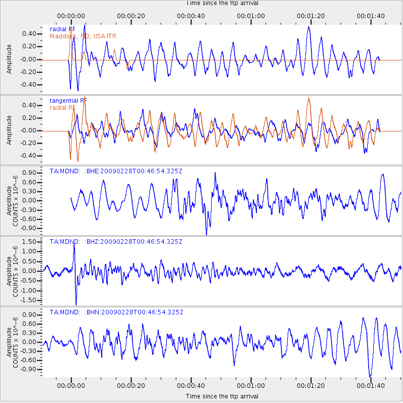
MDND Maddock, ND, USA - Earthquake Result Viewer
*The percent match for this event was below the threshold and hence no stack was calculated.
| Earthquake location: |
Hokkaido, Japan Region |
| Earthquake latitude/longitude: |
42.6/142.1 |
| Earthquake time(UTC): |
2009/02/28 (059) 00:35:56 GMT |
| Earthquake Depth: |
105 km |
| Earthquake Magnitude: |
5.5 MB, 5.5 MW, 5.5 MW |
| Earthquake Catalog/Contributor: |
WHDF/NEIC |
|
| Network: |
TA USArray Transportable Network (new EarthScope stations) |
| Station: |
MDND Maddock, ND, USA |
| Lat/Lon: |
47.85 N/99.60 W |
| Elevation: |
479 m |
|
| Distance: |
74.8 deg |
| Az: |
37.932 deg |
| Baz: |
317.644 deg |
| Ray Param: |
$rayparam |
*The percent match for this event was below the threshold and hence was not used in the summary stack. |
|
| Radial Match: |
71.3953 % |
| Radial Bump: |
400 |
| Transverse Match: |
78.3786 % |
| Transverse Bump: |
397 |
| SOD ConfigId: |
2658 |
| Insert Time: |
2010-03-06 02:58:13.462 +0000 |
| GWidth: |
2.5 |
| Max Bumps: |
400 |
| Tol: |
0.001 |
|
Signal To Noise
| Channel | StoN | STA | LTA |
| TA:MDND: :BHZ:20090228T00:46:54.325Z | 4.6181893 | 6.125961E-7 | 1.3264857E-7 |
| TA:MDND: :BHN:20090228T00:46:54.325Z | 1.1449655 | 2.4584006E-7 | 2.1471394E-7 |
| TA:MDND: :BHE:20090228T00:46:54.325Z | 1.2472739 | 3.6073715E-7 | 2.8922048E-7 |
| Arrivals |
| Ps | |
| PpPs | |
| PsPs/PpSs | |


