You are here: Home > Network List > TA - USArray Transportable Network (new EarthScope stations) Stations List
> Station MDND Maddock, ND, USA > Earthquake Result Viewer
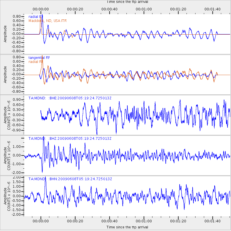
MDND Maddock, ND, USA - Earthquake Result Viewer
*The percent match for this event was below the threshold and hence no stack was calculated.
| Earthquake location: |
Honduras |
| Earthquake latitude/longitude: |
15.8/-86.9 |
| Earthquake time(UTC): |
2009/06/08 (159) 05:13:14 GMT |
| Earthquake Depth: |
10 km |
| Earthquake Magnitude: |
5.5 MB, 4.9 MS, 5.4 MW, 5.4 MW |
| Earthquake Catalog/Contributor: |
WHDF/NEIC |
|
| Network: |
TA USArray Transportable Network (new EarthScope stations) |
| Station: |
MDND Maddock, ND, USA |
| Lat/Lon: |
47.85 N/99.60 W |
| Elevation: |
479 m |
|
| Distance: |
33.7 deg |
| Az: |
344.454 deg |
| Baz: |
157.477 deg |
| Ray Param: |
$rayparam |
*The percent match for this event was below the threshold and hence was not used in the summary stack. |
|
| Radial Match: |
74.858574 % |
| Radial Bump: |
400 |
| Transverse Match: |
61.517418 % |
| Transverse Bump: |
400 |
| SOD ConfigId: |
2648 |
| Insert Time: |
2010-03-06 02:58:20.365 +0000 |
| GWidth: |
2.5 |
| Max Bumps: |
400 |
| Tol: |
0.001 |
|
Signal To Noise
| Channel | StoN | STA | LTA |
| TA:MDND: :BHZ:20090608T05:19:24.725013Z | 9.5691 | 9.818041E-7 | 1.026015E-7 |
| TA:MDND: :BHN:20090608T05:19:24.725013Z | 5.4822254 | 7.6808277E-7 | 1.4010419E-7 |
| TA:MDND: :BHE:20090608T05:19:24.725013Z | 2.2183628 | 4.852483E-7 | 2.1874162E-7 |
| Arrivals |
| Ps | |
| PpPs | |
| PsPs/PpSs | |


