You are here: Home > Network List > CI - Caltech Regional Seismic Network Stations List
> Station MUR Murrieta > Earthquake Result Viewer
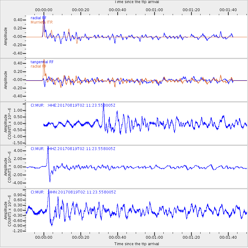
MUR Murrieta - Earthquake Result Viewer
*The percent match for this event was below the threshold and hence no stack was calculated.
| Earthquake location: |
Fiji Islands Region |
| Earthquake latitude/longitude: |
-18.0/-178.9 |
| Earthquake time(UTC): |
2017/08/19 (231) 02:00:52 GMT |
| Earthquake Depth: |
539 km |
| Earthquake Magnitude: |
6.4 Mww |
| Earthquake Catalog/Contributor: |
NEIC PDE/us |
|
| Network: |
CI Caltech Regional Seismic Network |
| Station: |
MUR Murrieta |
| Lat/Lon: |
33.60 N/117.20 W |
| Elevation: |
562 m |
|
| Distance: |
78.0 deg |
| Az: |
48.68 deg |
| Baz: |
238.928 deg |
| Ray Param: |
$rayparam |
*The percent match for this event was below the threshold and hence was not used in the summary stack. |
|
| Radial Match: |
79.29582 % |
| Radial Bump: |
297 |
| Transverse Match: |
63.831226 % |
| Transverse Bump: |
397 |
| SOD ConfigId: |
13570011 |
| Insert Time: |
2019-04-28 15:14:27.682 +0000 |
| GWidth: |
2.5 |
| Max Bumps: |
400 |
| Tol: |
0.001 |
|
Signal To Noise
| Channel | StoN | STA | LTA |
| CI:MUR: :HHZ:20170819T02:11:23.558005Z | 14.257301 | 1.9495615E-6 | 1.3674128E-7 |
| CI:MUR: :HHN:20170819T02:11:23.558005Z | 2.7315688 | 5.3228416E-7 | 1.9486389E-7 |
| CI:MUR: :HHE:20170819T02:11:23.558005Z | 4.33213 | 5.343233E-7 | 1.2333963E-7 |
| Arrivals |
| Ps | |
| PpPs | |
| PsPs/PpSs | |


