You are here: Home > Network List > TA - USArray Transportable Network (new EarthScope stations) Stations List
> Station MDND Maddock, ND, USA > Earthquake Result Viewer
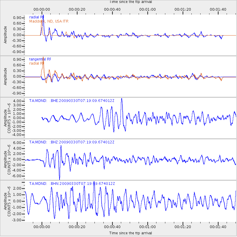
MDND Maddock, ND, USA - Earthquake Result Viewer
*The percent match for this event was below the threshold and hence no stack was calculated.
| Earthquake location: |
Kodiak Island Region, Alaska |
| Earthquake latitude/longitude: |
56.5/-152.7 |
| Earthquake time(UTC): |
2009/03/30 (089) 07:13:07 GMT |
| Earthquake Depth: |
21 km |
| Earthquake Magnitude: |
5.9 MB, 5.9 MS, 5.9 MW, 5.9 MW |
| Earthquake Catalog/Contributor: |
WHDF/NEIC |
|
| Network: |
TA USArray Transportable Network (new EarthScope stations) |
| Station: |
MDND Maddock, ND, USA |
| Lat/Lon: |
47.85 N/99.60 W |
| Elevation: |
479 m |
|
| Distance: |
32.9 deg |
| Az: |
82.292 deg |
| Baz: |
305.43 deg |
| Ray Param: |
$rayparam |
*The percent match for this event was below the threshold and hence was not used in the summary stack. |
|
| Radial Match: |
78.31874 % |
| Radial Bump: |
303 |
| Transverse Match: |
70.751114 % |
| Transverse Bump: |
400 |
| SOD ConfigId: |
2658 |
| Insert Time: |
2010-03-06 02:58:38.137 +0000 |
| GWidth: |
2.5 |
| Max Bumps: |
400 |
| Tol: |
0.001 |
|
Signal To Noise
| Channel | StoN | STA | LTA |
| TA:MDND: :BHZ:20090330T07:19:09.674012Z | 8.582483 | 1.8163515E-6 | 2.1163471E-7 |
| TA:MDND: :BHN:20090330T07:19:09.674012Z | 0.9597941 | 7.359E-7 | 7.6672694E-7 |
| TA:MDND: :BHE:20090330T07:19:09.674012Z | 2.6555896 | 1.3580399E-6 | 5.113892E-7 |
| Arrivals |
| Ps | |
| PpPs | |
| PsPs/PpSs | |


