You are here: Home > Network List > CN - Canadian National Seismograph Network Stations List
> Station INK INUVIK, NT > Earthquake Result Viewer
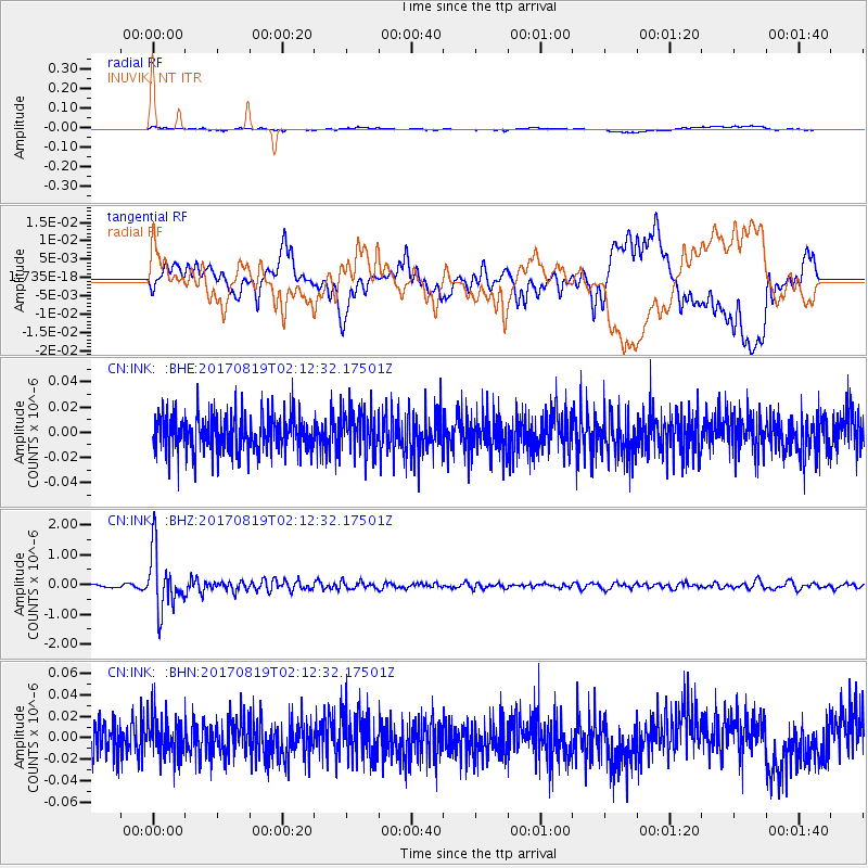
INK INUVIK, NT - Earthquake Result Viewer
*The percent match for this event was below the threshold and hence no stack was calculated.
| Earthquake location: |
Fiji Islands Region |
| Earthquake latitude/longitude: |
-18.0/-178.9 |
| Earthquake time(UTC): |
2017/08/19 (231) 02:00:52 GMT |
| Earthquake Depth: |
539 km |
| Earthquake Magnitude: |
6.4 Mww |
| Earthquake Catalog/Contributor: |
NEIC PDE/us |
|
| Network: |
CN Canadian National Seismograph Network |
| Station: |
INK INUVIK, NT |
| Lat/Lon: |
68.31 N/133.53 W |
| Elevation: |
44 m |
|
| Distance: |
92.1 deg |
| Az: |
15.34 deg |
| Baz: |
222.633 deg |
| Ray Param: |
$rayparam |
*The percent match for this event was below the threshold and hence was not used in the summary stack. |
|
| Radial Match: |
71.747215 % |
| Radial Bump: |
400 |
| Transverse Match: |
72.03971 % |
| Transverse Bump: |
400 |
| SOD ConfigId: |
13570011 |
| Insert Time: |
2019-04-28 15:15:07.905 +0000 |
| GWidth: |
2.5 |
| Max Bumps: |
400 |
| Tol: |
0.001 |
|
Signal To Noise
| Channel | StoN | STA | LTA |
| CN:INK: :BHZ:20170819T02:12:32.17501Z | 19.751722 | 9.820565E-7 | 4.9720043E-8 |
| CN:INK: :BHN:20170819T02:12:32.17501Z | 1.0993998 | 1.8114585E-8 | 1.6476795E-8 |
| CN:INK: :BHE:20170819T02:12:32.17501Z | 1.1185466 | 1.6055262E-8 | 1.4353682E-8 |
| Arrivals |
| Ps | |
| PpPs | |
| PsPs/PpSs | |


