You are here: Home > Network List > TA - USArray Transportable Network (new EarthScope stations) Stations List
> Station V35K Ketchikan, AK, USA > Earthquake Result Viewer
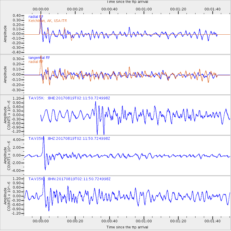
V35K Ketchikan, AK, USA - Earthquake Result Viewer
*The percent match for this event was below the threshold and hence no stack was calculated.
| Earthquake location: |
Fiji Islands Region |
| Earthquake latitude/longitude: |
-18.0/-178.9 |
| Earthquake time(UTC): |
2017/08/19 (231) 02:00:52 GMT |
| Earthquake Depth: |
539 km |
| Earthquake Magnitude: |
6.4 Mww |
| Earthquake Catalog/Contributor: |
NEIC PDE/us |
|
| Network: |
TA USArray Transportable Network (new EarthScope stations) |
| Station: |
V35K Ketchikan, AK, USA |
| Lat/Lon: |
55.33 N/131.62 W |
| Elevation: |
64 m |
|
| Distance: |
83.2 deg |
| Az: |
24.991 deg |
| Baz: |
224.724 deg |
| Ray Param: |
$rayparam |
*The percent match for this event was below the threshold and hence was not used in the summary stack. |
|
| Radial Match: |
76.99517 % |
| Radial Bump: |
400 |
| Transverse Match: |
38.990395 % |
| Transverse Bump: |
291 |
| SOD ConfigId: |
13570011 |
| Insert Time: |
2019-04-28 15:20:54.951 +0000 |
| GWidth: |
2.5 |
| Max Bumps: |
400 |
| Tol: |
0.001 |
|
Signal To Noise
| Channel | StoN | STA | LTA |
| TA:V35K: :BHZ:20170819T02:11:50.724998Z | 6.840348 | 2.0483003E-6 | 2.9944388E-7 |
| TA:V35K: :BHN:20170819T02:11:50.724998Z | 2.7493784 | 5.636384E-7 | 2.0500576E-7 |
| TA:V35K: :BHE:20170819T02:11:50.724998Z | 2.152393 | 5.617583E-7 | 2.6099244E-7 |
| Arrivals |
| Ps | |
| PpPs | |
| PsPs/PpSs | |


