You are here: Home > Network List > TA - USArray Transportable Network (new EarthScope stations) Stations List
> Station WHTX Lake Whitney, Meridian, TX, USA > Earthquake Result Viewer
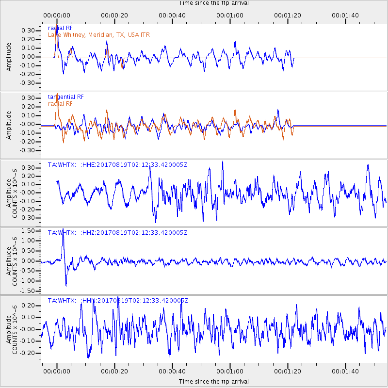
WHTX Lake Whitney, Meridian, TX, USA - Earthquake Result Viewer
*The percent match for this event was below the threshold and hence no stack was calculated.
| Earthquake location: |
Fiji Islands Region |
| Earthquake latitude/longitude: |
-18.0/-178.9 |
| Earthquake time(UTC): |
2017/08/19 (231) 02:00:52 GMT |
| Earthquake Depth: |
539 km |
| Earthquake Magnitude: |
6.4 Mww |
| Earthquake Catalog/Contributor: |
NEIC PDE/us |
|
| Network: |
TA USArray Transportable Network (new EarthScope stations) |
| Station: |
WHTX Lake Whitney, Meridian, TX, USA |
| Lat/Lon: |
31.99 N/97.46 W |
| Elevation: |
190 m |
|
| Distance: |
92.3 deg |
| Az: |
57.23 deg |
| Baz: |
250.374 deg |
| Ray Param: |
$rayparam |
*The percent match for this event was below the threshold and hence was not used in the summary stack. |
|
| Radial Match: |
66.881584 % |
| Radial Bump: |
361 |
| Transverse Match: |
61.69416 % |
| Transverse Bump: |
368 |
| SOD ConfigId: |
13570011 |
| Insert Time: |
2019-04-28 15:20:55.076 +0000 |
| GWidth: |
2.5 |
| Max Bumps: |
400 |
| Tol: |
0.001 |
|
Signal To Noise
| Channel | StoN | STA | LTA |
| TA:WHTX: :HHZ:20170819T02:12:33.420005Z | 7.619488 | 5.6402394E-7 | 7.4023866E-8 |
| TA:WHTX: :HHN:20170819T02:12:33.420005Z | 0.8814439 | 5.886555E-8 | 6.678309E-8 |
| TA:WHTX: :HHE:20170819T02:12:33.420005Z | 1.9455624 | 1.6902516E-7 | 8.687728E-8 |
| Arrivals |
| Ps | |
| PpPs | |
| PsPs/PpSs | |


