
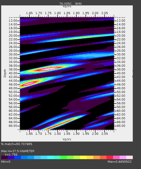
O05C Quincy, CA, USA - Earthquake Result Viewer
| ||||||||||||||||||
| ||||||||||||||||||
| ||||||||||||||||||
|
Signal To Noise
| Channel | StoN | STA | LTA |
| TA:O05C: :BHN:20070716T01:24:26.500005Z | 19.075424 | 7.30328E-7 | 3.828633E-8 |
| TA:O05C: :BHE:20070716T01:24:26.500005Z | 12.3477955 | 9.431419E-7 | 7.6381404E-8 |
| TA:O05C: :BHZ:20070716T01:24:26.500005Z | 20.611803 | 2.023925E-6 | 9.819252E-8 |
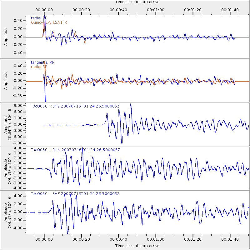
| Arrivals | |
| Ps | 4.4 SECOND |
| PpPs | 15 SECOND |
| PsPs/PpSs | 20 SECOND |

