You are here: Home > Network List > TA - USArray Transportable Network (new EarthScope stations) Stations List
> Station D23K Nanushuk River, AK USA > Earthquake Result Viewer
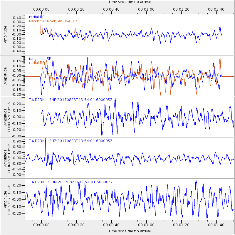
D23K Nanushuk River, AK USA - Earthquake Result Viewer
*The percent match for this event was below the threshold and hence no stack was calculated.
| Earthquake location: |
Iran-Iraq Border Region |
| Earthquake latitude/longitude: |
36.2/45.0 |
| Earthquake time(UTC): |
2017/08/23 (235) 13:42:53 GMT |
| Earthquake Depth: |
10 km |
| Earthquake Magnitude: |
5.6 mb |
| Earthquake Catalog/Contributor: |
NEIC PDE/us |
|
| Network: |
TA USArray Transportable Network (new EarthScope stations) |
| Station: |
D23K Nanushuk River, AK USA |
| Lat/Lon: |
68.97 N/150.68 W |
| Elevation: |
406 m |
|
| Distance: |
74.5 deg |
| Az: |
5.801 deg |
| Baz: |
346.905 deg |
| Ray Param: |
$rayparam |
*The percent match for this event was below the threshold and hence was not used in the summary stack. |
|
| Radial Match: |
63.891193 % |
| Radial Bump: |
400 |
| Transverse Match: |
52.42163 % |
| Transverse Bump: |
400 |
| SOD ConfigId: |
13570011 |
| Insert Time: |
2019-04-28 15:28:35.806 +0000 |
| GWidth: |
2.5 |
| Max Bumps: |
400 |
| Tol: |
0.001 |
|
Signal To Noise
| Channel | StoN | STA | LTA |
| TA:D23K: :BHZ:20170823T13:54:01.600005Z | 3.293062 | 3.0863785E-7 | 9.372367E-8 |
| TA:D23K: :BHN:20170823T13:54:01.600005Z | 1.5731627 | 1.17317306E-7 | 7.4574174E-8 |
| TA:D23K: :BHE:20170823T13:54:01.600005Z | 1.4300299 | 1.00903904E-7 | 7.0560695E-8 |
| Arrivals |
| Ps | |
| PpPs | |
| PsPs/PpSs | |


