You are here: Home > Network List > TA - USArray Transportable Network (new EarthScope stations) Stations List
> Station D25K Kavik River, AK, USA > Earthquake Result Viewer
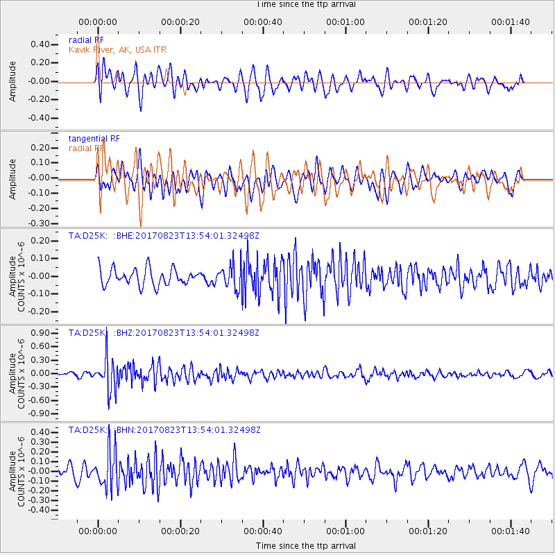
D25K Kavik River, AK, USA - Earthquake Result Viewer
*The percent match for this event was below the threshold and hence no stack was calculated.
| Earthquake location: |
Iran-Iraq Border Region |
| Earthquake latitude/longitude: |
36.2/45.0 |
| Earthquake time(UTC): |
2017/08/23 (235) 13:42:53 GMT |
| Earthquake Depth: |
10 km |
| Earthquake Magnitude: |
5.6 mb |
| Earthquake Catalog/Contributor: |
NEIC PDE/us |
|
| Network: |
TA USArray Transportable Network (new EarthScope stations) |
| Station: |
D25K Kavik River, AK, USA |
| Lat/Lon: |
69.32 N/146.38 W |
| Elevation: |
770 m |
|
| Distance: |
74.5 deg |
| Az: |
4.159 deg |
| Baz: |
350.488 deg |
| Ray Param: |
$rayparam |
*The percent match for this event was below the threshold and hence was not used in the summary stack. |
|
| Radial Match: |
62.6821 % |
| Radial Bump: |
400 |
| Transverse Match: |
50.25161 % |
| Transverse Bump: |
400 |
| SOD ConfigId: |
13570011 |
| Insert Time: |
2019-04-28 15:28:36.222 +0000 |
| GWidth: |
2.5 |
| Max Bumps: |
400 |
| Tol: |
0.001 |
|
Signal To Noise
| Channel | StoN | STA | LTA |
| TA:D25K: :BHZ:20170823T13:54:01.32498Z | 6.657291 | 3.6473375E-7 | 5.478711E-8 |
| TA:D25K: :BHN:20170823T13:54:01.32498Z | 4.4095407 | 1.9345794E-7 | 4.3872582E-8 |
| TA:D25K: :BHE:20170823T13:54:01.32498Z | 1.4808011 | 6.870031E-8 | 4.6394014E-8 |
| Arrivals |
| Ps | |
| PpPs | |
| PsPs/PpSs | |


