You are here: Home > Network List > TA - USArray Transportable Network (new EarthScope stations) Stations List
> Station G23K Bananza Creek, AK, USA > Earthquake Result Viewer
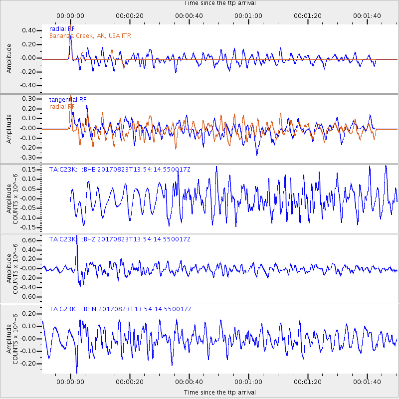
G23K Bananza Creek, AK, USA - Earthquake Result Viewer
*The percent match for this event was below the threshold and hence no stack was calculated.
| Earthquake location: |
Iran-Iraq Border Region |
| Earthquake latitude/longitude: |
36.2/45.0 |
| Earthquake time(UTC): |
2017/08/23 (235) 13:42:53 GMT |
| Earthquake Depth: |
10 km |
| Earthquake Magnitude: |
5.6 mb |
| Earthquake Catalog/Contributor: |
NEIC PDE/us |
|
| Network: |
TA USArray Transportable Network (new EarthScope stations) |
| Station: |
G23K Bananza Creek, AK, USA |
| Lat/Lon: |
66.71 N/150.02 W |
| Elevation: |
746 m |
|
| Distance: |
76.8 deg |
| Az: |
6.066 deg |
| Baz: |
347.579 deg |
| Ray Param: |
$rayparam |
*The percent match for this event was below the threshold and hence was not used in the summary stack. |
|
| Radial Match: |
53.578762 % |
| Radial Bump: |
400 |
| Transverse Match: |
57.85822 % |
| Transverse Bump: |
400 |
| SOD ConfigId: |
13570011 |
| Insert Time: |
2019-04-28 15:29:00.826 +0000 |
| GWidth: |
2.5 |
| Max Bumps: |
400 |
| Tol: |
0.001 |
|
Signal To Noise
| Channel | StoN | STA | LTA |
| TA:G23K: :BHZ:20170823T13:54:14.550017Z | 5.31016 | 2.3758251E-7 | 4.474112E-8 |
| TA:G23K: :BHN:20170823T13:54:14.550017Z | 1.6115459 | 1.0340731E-7 | 6.416653E-8 |
| TA:G23K: :BHE:20170823T13:54:14.550017Z | 1.325102 | 7.250292E-8 | 5.4714974E-8 |
| Arrivals |
| Ps | |
| PpPs | |
| PsPs/PpSs | |


