You are here: Home > Network List > TA - USArray Transportable Network (new EarthScope stations) Stations List
> Station G31M Satah River, YT, CAN > Earthquake Result Viewer
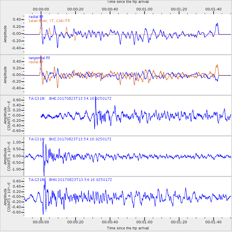
G31M Satah River, YT, CAN - Earthquake Result Viewer
*The percent match for this event was below the threshold and hence no stack was calculated.
| Earthquake location: |
Iran-Iraq Border Region |
| Earthquake latitude/longitude: |
36.2/45.0 |
| Earthquake time(UTC): |
2017/08/23 (235) 13:42:53 GMT |
| Earthquake Depth: |
10 km |
| Earthquake Magnitude: |
5.6 mb |
| Earthquake Catalog/Contributor: |
NEIC PDE/us |
|
| Network: |
TA USArray Transportable Network (new EarthScope stations) |
| Station: |
G31M Satah River, YT, CAN |
| Lat/Lon: |
66.92 N/134.27 W |
| Elevation: |
61 m |
|
| Distance: |
77.2 deg |
| Az: |
359.694 deg |
| Baz: |
0.627 deg |
| Ray Param: |
$rayparam |
*The percent match for this event was below the threshold and hence was not used in the summary stack. |
|
| Radial Match: |
63.328384 % |
| Radial Bump: |
400 |
| Transverse Match: |
74.260124 % |
| Transverse Bump: |
400 |
| SOD ConfigId: |
13570011 |
| Insert Time: |
2019-04-28 15:29:05.494 +0000 |
| GWidth: |
2.5 |
| Max Bumps: |
400 |
| Tol: |
0.001 |
|
Signal To Noise
| Channel | StoN | STA | LTA |
| TA:G31M: :BHZ:20170823T13:54:16.925017Z | 7.4129305 | 5.225069E-7 | 7.0485875E-8 |
| TA:G31M: :BHN:20170823T13:54:16.925017Z | 3.8183858 | 3.2676456E-7 | 8.5576616E-8 |
| TA:G31M: :BHE:20170823T13:54:16.925017Z | 3.3890157 | 2.368781E-7 | 6.989584E-8 |
| Arrivals |
| Ps | |
| PpPs | |
| PsPs/PpSs | |


