You are here: Home > Network List > TA - USArray Transportable Network (new EarthScope stations) Stations List
> Station I30M Mount Dempster, Yukon, CAN > Earthquake Result Viewer
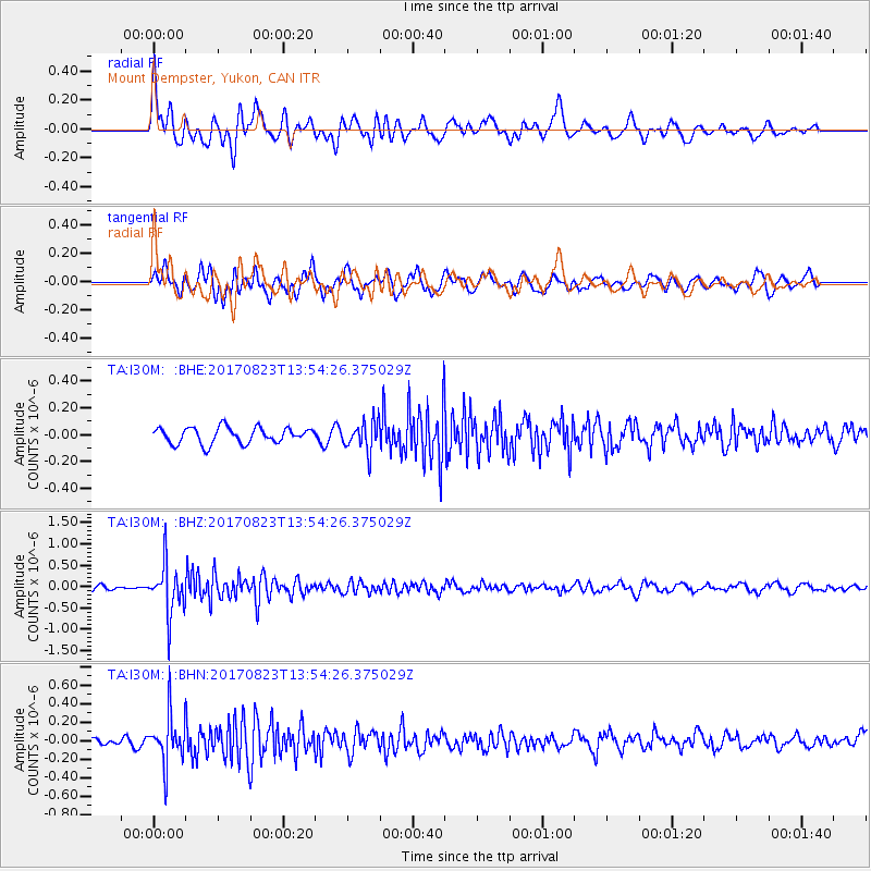
I30M Mount Dempster, Yukon, CAN - Earthquake Result Viewer
*The percent match for this event was below the threshold and hence no stack was calculated.
| Earthquake location: |
Iran-Iraq Border Region |
| Earthquake latitude/longitude: |
36.2/45.0 |
| Earthquake time(UTC): |
2017/08/23 (235) 13:42:53 GMT |
| Earthquake Depth: |
10 km |
| Earthquake Magnitude: |
5.6 mb |
| Earthquake Catalog/Contributor: |
NEIC PDE/us |
|
| Network: |
TA USArray Transportable Network (new EarthScope stations) |
| Station: |
I30M Mount Dempster, Yukon, CAN |
| Lat/Lon: |
65.22 N/136.38 W |
| Elevation: |
1399 m |
|
| Distance: |
78.9 deg |
| Az: |
0.579 deg |
| Baz: |
358.887 deg |
| Ray Param: |
$rayparam |
*The percent match for this event was below the threshold and hence was not used in the summary stack. |
|
| Radial Match: |
77.5106 % |
| Radial Bump: |
400 |
| Transverse Match: |
67.52976 % |
| Transverse Bump: |
400 |
| SOD ConfigId: |
13570011 |
| Insert Time: |
2019-04-28 15:29:21.723 +0000 |
| GWidth: |
2.5 |
| Max Bumps: |
400 |
| Tol: |
0.001 |
|
Signal To Noise
| Channel | StoN | STA | LTA |
| TA:I30M: :BHZ:20170823T13:54:26.375029Z | 8.169852 | 5.8147185E-7 | 7.117287E-8 |
| TA:I30M: :BHN:20170823T13:54:26.375029Z | 5.12146 | 2.6244535E-7 | 5.1244243E-8 |
| TA:I30M: :BHE:20170823T13:54:26.375029Z | 1.8571441 | 1.10122336E-7 | 5.9296603E-8 |
| Arrivals |
| Ps | |
| PpPs | |
| PsPs/PpSs | |


